Archive | 2019 Bike Trip – C&O Canal Towpath/Great Allegheny Passage RSS feed for this section

GAP/C&O-Day 12-Last Day on the Trail

17 Jul

Today would be our last day on the GAP, having explored the C&O Canal Towpath and the Great Allegheny Passage from Harper’s Ferry, WV to Buena Vista, PA. It’s been a wonderful trip! The trail conditions were much better than we anticipated, even on the C&O. I think we were expecting the worst since it can be the trail most affected by weather conditions, but we were pleasantly surprised.

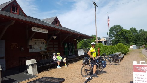
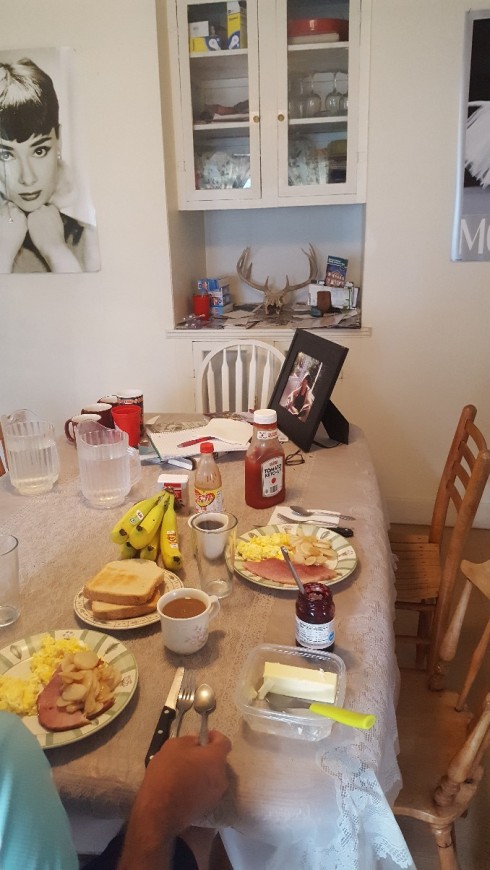
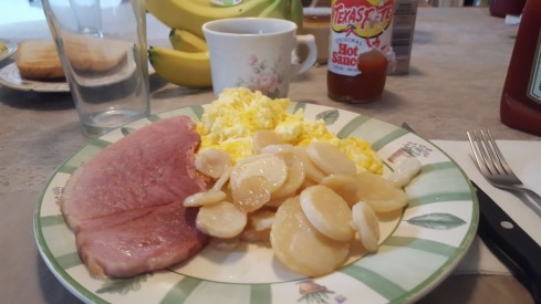
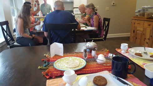
We stayed the night in West Newton, PA at Bright Morning B&B. We had arranged to eat an early breakfast, and had walked over to the Bistro (in a house adjacent to the one where we were staying) to get coffee while we waited. Soon we were sitting down to a hearty breakfast of sausage, scrambled eggs, breakfast strata and fruit. We were well fueled for our last bike ride of the trip!

Bright Morning Breakfast

We wanted to get an early start because of the forecast of rain, so we gathered our gear and headed out. I love this view of the little church across the street from our B&B, just as the sun came up this morning.

church sunrise

We were traveling back toward Connellsville where our truck was parked, so we were not seeing new trail today, but enjoyed the ride none the less.

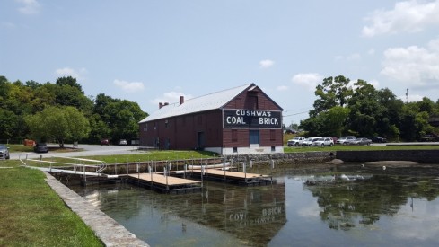
We made good time, and planned to stop in a little town we’d missed on the ride the day before. One of the folks we met along the trail had told us about Dawson, PA. It was a little town a short distance off the trail, but had been named to the National Register of Historic places due to the number of historic homes.

We took the bridge over the river and into town, and rolled in just in time to wait for a train to cross through the middle of town.

Dawson train

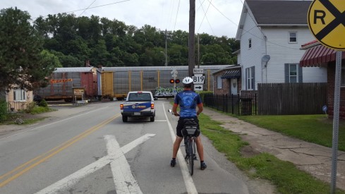
We continued on once the trained had passed and pedaled through the tiny town admiring the old homes and varied architectural periods.

I saw an old town clock in front of a building, and stopped to take a picture.

town clock

I noticed the building was the town’s historical society, and tried the door, but it was locked. We pedaled on around the block and down the street and saw a couple of monuments and flags commemorating the town’s war veterans. There was an older gentleman clipping grass and tending the flowers and we stopped to talk to him. He introduced himself as John, and we visited with him for several minutes.

war memorial2

He asked about our ride and shared with us some interesting history about the little town of Dawson. At one time, the town was very well to do and was the home of 6 millionaires during the coal and coke era. That was the reason for the number of elaborate historic homes.

We enjoyed our visit with him right there on the street. We were just about to leave, allowing him to get back to his work of tending the flowers, when he asked us if we were in a hurry to get back on the trail. We told him that we weren’t, it was our last day and we were taking our time getting back to the B&B so as not to miss anything.

He said he was a member of the historical society and had a key to the building. He offered to go get his key and meet us there if we would be interested in seeing it. We told him we’d love to see it, so we headed back up the street and parked our bikes on the porch of the little building while he walked home and got his key. His neat two story house was right on the way and he soon met us with the key.

Inside the building was a very thorough collection of items from the Dawson area. He said the AC was on and it was very cool inside, a nice change from the muggy trail. He gave us a private tour, room by room, even though he was in sweaty work clothes and I’m sure had things he needed to do. But he seemed to enjoy sharing the history of his town with us and we definitely enjoyed seeing the old items in the collection. He told me I could take pictures of anything I wanted.

The building was much bigger on the inside than it appeared to be on the outside. There were rooms full of old photos of the town and buildings, old signs and posters, a room dedicated to the history of the coal mining era, a school room, a room full of Indian arrowheads and artifacts, old wedding dresses and evening gowns, old hand written ledgers and record books from businesses that used to be in the town during it’s heyday. It was all very interesting.

He offered us a cold soft drink from the fridge in the kitchen as we walked through to the rear of the building. We both drank an ice cold root beer! The kitchen was not part of the museum, but it could have been since it was a step back in time, having not been remodeled for years. I loved the kitchen cabinets! Very retro!

retro kitchen

Then we reached the room that contained the piece de resistance. A whole room full of the most amazing model train set I’d ever seen. It was a beautiful work by a gentleman from Gaithersburg, MD. Sam Powell had built the model railroad piece by piece in his basement over a period of years! Sadly though, Mr. Powell passed away suddenly in January of 2016 while shoveling snow. His family searched for a museum in the Southwest Pennsylvania area to become the new home of his masterpiece. Since the little town of Dawson was in the area from which Mr. Powell drew inspiration in designing his model railroad, the gift was offered to them.

It was a tremendous gift for tiny Tri-Town Area Historical Society, and required a special room, sized in the same dimensions as Mr. Powell’s basement. Our new friend John, showed us where they had to knock out and extend one wall to be able to accept the gift. Also, the room had to be climate controlled to a specific temperature so the train and tracks would operate properly.

The railroad arrived on a 53 foot trailer, and was in pieces. The historical society folks opened up the trailer and had no clue how to reassemble. Into the story came another group of generous individuals. Mr. Powell’s family had reached out to a model train group in Pittsburgh to see if they’d be willing to lend assistance in reassembling the train. The S-Guagers model train club stepped in and volunteered 1 1/2 years of their time to reassemble the model train! Through all these obstacles, this little historical society was up to the challenge, and today folks come from all over to see Mr. Powell’s amazing model railroad. What a special gift the family made to the little town of Dawson, with a population of 353!

We spent a good bit of time looking at the model railroad. It was just amazing and all made by hand. But we didn’t want to outstay our welcome since we’d taken John away from his work at the war memorial. We signed the guest book and thanked him for our private tour. It was such a treat!

He seemed to enjoy the tour just as much as we did. He said it helps him to stay busy these days since his wife passed away 3 1/2 years ago, and he tries to stay involved in his town and in the historical society. God bless him!

He was such a kind man, taking time out of his day to share a museum with us! We have certainly met many nice people on this trip, and the memory of our private tour of an amazing museum in little Dawson, PA will be a fond one.

We now know why the Great Allegheny Passage is touted as the friendliest bike path in the US. It certainly lives up to its claim. We met nice people at every stop and trail town along the way. I’m so glad we got to mark this one off the bucket list.

GAP/C&O-Day 10 & 11

17 Jul

smithhousebrkfst

We came down to a beautifully set breakfast table at the Smith House Inn. The big porch doors and windows were open, allowing the fresh, cool morning air into the house through the screens. We enjoyed every bite as we visited with the other guests from Austin, TX. Our ride today takes us from Confluence to Connellsville, where we left our truck 9 days ago.

We finished our breakfast, hopped on the bikes and were off on a cool foggy morning. We crossed 2 bridges as we left Confluence and were once again enjoying the beauty of the trail.

It was a short ride to Ohiopyle, and we had time to walk around, checking out the little shops and the old church.


We grabbed an early lunch at a farm to table restaurant called the Ohiopyle House Cafe.

Ohiopyle State Park is situated right in the center of the beautiful Laurel Highlands, a mountainous region encompassing 3000 square miles in southwest Pennsylvania. I imagine it is extremely busy on the weekends with the hiking trails, bike path, whitewater rafting and waterfall tours. We were glad we caught it on a Monday.

Once we finished lunch, we biked over to Wilderness Voyageurs. They run an outfitters store and offer a number of guided trips and services including a shuttle service. We’d arranged for them to shuttle us the 3 miles over to Fallingwater to take a tour of the famous house designed by Frank Lloyd Wright. Once we saw the very hilly road with no shoulder for biking, we knew we’d made a wise decision. I would not recommend riding it by bike. It was only 3 miles, but it would have been a very difficult and dangerous ride by bike.

We had purchased our tickets for the home tour online a couple of days ago, when we saw that we would be able to make the timing work. Reservations are recommended because the house is a very popular attraction, and tickets typically sell out. Only last week the home was declared a UNESCO World Heritage Site, so I was delighted we were able to work it in to our schedule.

The folks at Wilderness Voyaguers transported us to Fallingwater with plenty of time to spare, and told us to call them when we wanted to be picked up. They dropped us right at the front of the visitor center.

When we checked in for the tour, we were offered an earlier tour, probably due to a cancellation, and we gladly accepted it.  The tour was very interesting and included every room in the house as well as the guest house and carport. No pictures were allowed in the home, but we were allowed to take photos outside of the home after the tour.

We finished the tour, stopped by the cafe in the visitor center to get a cold soda to drink as we waited for our shuttle and even got a free cookie provided in celebration of becoming a UNESCO World Heritage site.

Fallingwater visitor cntr

The shuttle picked us up within a few short minutes of placing the call. We got back on our bikes, which we’d left at Wilderness Voyageurs while we were on the tour. We continued on with our exploration of the Great Allegheny Passage.

We had 17 more miles to cover before we arrived back at our truck, parked at the Connellsville B&B. We’d been away from the truck for 9 days, the longest time we’ve been on a bike trail self-supported. We were able to take everything we needed on our bikes, and there were a few items I took that I didn’t use at all, so next time, I may be able to pack even lighter.

We arrived back at the Connellsville B&B and saw our truck was safe and sound right where we’d left it. The owner greeted us, asked us about our week and took us up to our room. We were in a different room this time and it had beautiful views of the little main street through town.

We got cleaned up and walked down to a family owned Italian restaurant just a couple of blocks from the B&B. Reservations are recommended at Ruvo’s, because it is a very small place, though they did have outdoor seating. Food is served family style, and includes salad and bread. We both ordered one of the specials. One was sausage tortellini and one was gnocchi. The special of the night is a one-serving dish, though it was more than I could eat!

Day 11 was our day to explore more of the trail toward Pittsburgh. We hadn’t started the combined C&O/GAP trail all the way in DC, and we didn’t plan to go all the way to Pittsburgh, but we wanted to see more of the trail in that direction. So after a good breakfast at the Connellsville B&B, we started out toward Pittsburgh.

The trail continues to be in excellent condition and the scenery beautiful. We rode all the way to West Newton (where our B&B is for the night) and stopped and ate lunch at Trailside Cafe. We sat on the deck overlooking the bike trail. I had a delicious salad and Jimmy had a club sandwich. Delicious!

After lunch, we continued on toward Pittsburgh to explore more of the trail in that direction. We passed our B&B as we pedaled through town on the trail. It is directly across from the old train depot, repurposed as a trail visitor center with clean restrooms, water, maps, t-shirts and a friendly staff. We stopped and looked around a bit, and bought t-shirts. We were asked to sign the guest register, as we’ve been asked at every similar stop. These little visitor centers depend on people signing their guest books because it helps them with their funding. So SIGN the guest books when you stop. It helps insure that little places like this will still remain open.

This area had a number of coal mines, all gone now. As we followed the trail along the bank of the Youghiogheny River, or the Yough (prononced Yock -rhymes with sock) as the locals call it, we spotted several relics left from the coal mine era. There were also a good number of signs explaining the relics and giving a history of the area. Also this chunk of coal placed on a sign placard.

coal

The town of Connellsville was at the center of the “Coke Region”. Until the end of World War I, the area around the town was unrivaled in the production of coke, and was known as the coke capitol of the world.

Coke is a hard porous coal residue with a high heating value. It is made by “cooking” coal in sealed ovens. The ovens are beehive shaped and line the banks along both sides of the river. Back in the “coke” heydey, the fires from 35,000 ovens lit up the night sky surrounding Connellsville. I’m sure that was a site to see back in the day.

When the coke was ready, it was loaded onto railcars bound for Pittsburgh and used in the making of steel.

In one particular section of trail, I was able to spot the beehive ovens every few feet lining on old road or railroad on a hillside along the trail. It was hard to get a photo because of the foliage. The ovens would probably be much easier to spot in the winter, but I did take a short little hike off the trail to get a picture of one.

beehive oven

I read all the historical markers about the coal mines along the trail.  We passed through 3 or 4 “patch towns”. Patch towns were small villages consisting of “company houses”. The Pittsburgh Coal Company provided housing for their employees working in the mines and at the coke ovens. Most were built between 1900-1920. There were only a few floorplans. They consisted of duplexes, larger homes for managers, and bunk houses for employees with no family. Though most have been updated to some degree, the lay-out of the company town is still the same, and though many of them are single family homes now, you can still see the footprint of the duplex with 2 front doors, etc. All of the homes in these little patch towns have the same footprint and it is interesting to see how homeowners have modified them to make them uniquely theirs.

There was a terrible mining accident in this region in 1907. A gas and coal dust explosion killed 239 miners at Darr Mine, and was one of the worst coal mine tragedies in the US. A historical marker is placed near the trail telling the story of the Darr mine disaster.

One other remnant of the coal mining era can be seen along the trail, Red Waterfall. Red Waterfall flows from water that comes from far underground. The unusual thing about the waterfall though is its color. A rock seal that formed over the massive Pittsburgh coal seam thousands of years ago contained “pyrite”, made of iron and sulfur. Coal mining exposed pyrite to oxygen and ground water. This in turn produced sulfuric acid and a number of red, yellow, and orange compounds. The rich orange/red color came from iron, and is known as Acid Mine Drainage. This was the largest orange/red water we saw, but noticed it in a smaller waterfall and in a creek that runs along the trail. All were remnants of the coal mining that occurred here over 100 years ago.

Red Falls

We traveled on and stopped for an ice cream cone at Yough Twister. We got a blackberry vanilla yogurt swirl. It was a cute tiny place with a huge menu. I was sorry we weren’t there at meal time!

There are several spots along the trail where homeowners that border the trail have added extra touches to make trail users feel welcome. We saw a number of shady benches with flowers tended in pots, an inviting bench under an old shady apple tree, and a cooler of bottled water for any thirsty traveler. These little places always make me smile!

Shortly after passing Buena Vista, we turned around and headed back toward our B&B, having ridden to  within 27 miles  of Pittsburgh. We passed many more beautiful sites, and I took a few more pictures even though we had doubled back. I couldn’t resist!

We are staying in West Newton at Bright Morning Bed & Breakfast. We’d passed it earlier in the day on our way out to see more of the trail, and were ready to get back to it and check in.

Bright Morning B&B2

The B&B is made up of 4 homes bought over a period of years by the owner. The first house she bought was one that an elderly lady had left to the local Methodist Church. The church sold it and she bought it. She started out with one guest room and the demand was so high, she added other homes to her collection. All of the homes have been lovingly restored. Breakfast would be serve in another of the homes 2 doors down from the one we were in. Our room was on the top floor of the green house with a beautiful view of the bike trail and the old train depot.

We returned to the Trailside Cafe for dinner, and once again sat on the deck overlooking the bike trail. It was a beautiful ending to the day. We are both sad to see this trip end. But have already begun dreaming about our next bike trip! Tomorrow, we pedal back to our truck in Connellsville, spend one last night, and head home.


GAP/C&O-Day 9-Laurel Highlands

15 Jul

Yoder's breakfast

Breakfast at Yoder’s Guest House was self serve. We were the only guests last night, so we were able to eat when we wanted, not having to wait for a set time. The owner had left the fridge stocked with yogurts, boiled eggs, juice, and milk, plus there was fruit, cereals, oatmeal, bagels, and English muffins. We had no problem filling up.

We headed out on another beautiful day, anxious to see more of the Laurel Highlands. The mountain streams running along the path became larger and swifter, and the wildflowers more abundant.


Soon after we left Meyersdale, we crossed over the spectacular Salisbury Viaduct. The first train crossed the 101-foot high trestle in 1912. It was quite an undertaking for the engineers of the day. The trestle is 1908 feet long, and has beautiful views of the Casselman River Valley. I took several pictures along the trestle.


A little further up the trail, right on the other side of the viaduct was a small family cemetery. I looked at the old headstones for a bit and it was in a beautiful spot right near the river with views of big farms all around.

cemetery

I’ve noticed several homeowners along the trail set out coolers of bottled water for thirsty bikers and hikers using the trail. The water fountains are not quite as plentiful along the GAP, as they were on the C&O, so I would bet these get quite a bit of use. This one was ingeniously designed, with donations being dropped through a slot in the fence.

water stop

We saw small waterfalls as we traveled on, as well as a profusion of wildflowers.


I stopped along the trail to photograph a waterfall and we talked to a gentleman that was also riding. When we pulled up, he was in the grass to the side of the trail looking for something. He explained that his riding partner had passed away recently and he had planted some wildflowers at one of their favorite spots along the trail. He was looking to see if any had come up. He had chosen flowers that had meaning, like a variety called snow drop because his friend had enjoyed snow skiing. I have forgotten the other two varieties, but he explained how he chose them based on memories he’d shared with this special friend. He told us of some of the adventures he and his riding buddy had experienced in the past. I felt sad that he’d lost his friend but was glad he was still out enjoying the trails. We visited with him for quite some time, then asked him if he knew of a lunch place to recommend ahead on the trail. He mentioned a nice restaurant in Rockwood in an old restored opera house. He was friends with the owner, in fact the place we were standing and talking was at the boundary of their land. They owned a thousand acres alongside the railtrail. He knew the owner personally and said it was a very good place to eat, but he wasn’t sure if it was open today. We told him we’d take a little detour into Rockwood and check it out since we were traveling in that direction.

We continued on and before too long, we pulled off in Rockwood,  followed his instructions to the restaurant and crossed the river. We were headed into town to see if the restaurant was open. However, there was a train stalled on the tracks and we were unable to make it over to the opera house. There were a number of cars waiting in line to cross, and it seemed they’d been there for some time.


We decided to turn around and go back to the trail where we’d seen a shelter and some picnic tables and eat the snacks we’d purchased at the convenience store the night before. We’d make up for it at dinner!

We were just finishing up our convenience store meal, when the gentleman we’d talked to earlier on the trail pedaled up. Apparently he had ridden ahead trying to determine if the opera house restaurant was open, then he planned to pedal back to us to let us know for sure so we didn’t have to make an unnecessary detour off the trail if the restaurant happened to be closed. He was able to cross the track before the train stalled, and he determined that the restaurant was indeed closed today, but then he couldn’t get back across the track because of the stalled train. Finally, after waiting several minutes, the stalled train slowly pulled away, but before the crossing gates lifted, another train roared in and he had to wait for that one as well.

He found us at the trailhead and explained all of that to us as we finished up our meal. He said he had never gotten stuck on the other side of the tracks before, and he rides that section quite often. It was such an unexpected kindness from a complete stranger! He wanted to help us find the best possible lunch in the area, and we could tell he was really disappointed that we didn’t get to try it. How nice of him to take the time to pedal all the way into Rockwood to find out, then try to get back to us before we had to take the detour for nothing. There truly are good people everywhere!

More lovely countryside awaited, so we bid our new friend goodbye and rode the last length of trail before stopping at Confluence. We crossed one other trestle bridge with beautiful views, then on to our destination for the night.


Here’s our view as we crossed the last bridge into Confluence.


Confluence, PA is a beautiful little town. Each home and B&B is neat and tidy. I don’t think we saw a messy yard anywhere!

entering Confluence

The town gets its name from the confluence of three rivers, and sits on the point where they meet. The Youghiogheny, Laurel Hill, and the Casselman Rivers all come together here.  Though the locals pronounce the town name a little differently than I would. It is pronounced with two syllables here and sounds like CON fluns.

We made it to the Smith House Inn a little early. The caretaker was just a few minutes in arriving, but we enjoyed talking to a family from Austin, TX who are also staying the night.

Smith House

The home is beautiful, built in 1920. Our hostess showed us around, and took us up to our room.


She said the house has been kept in remarkably good conditions, with very few changes to the original fixtures. All the light fixtures were original, original hardwood floors and I loved the big farmhouse sink in the kitchen!


We got cleaned up and walked down to eat dinner at River’s Edge Cafe. It was delicious! And I don’t think it was because we just snacked for lunch. The food and service were great. We sat on the porch overlooking a garden of wildflowers at the edge of the river.


I ordered the crabcakes and Jimmy went for the surf and turf. We felt we deserved dessert after our ride today, so I went with the peanut butter pie, and he tried the lemon berry cake. Delicious!


It was the perfect ending to a beautiful day. Tomorrow on to Ohiopyle State Park, then Connellsville, where our truck has been waiting for us for 9 days!


GAP/C&O-Day 8-Mile Zero, The Line, The Divide

14 Jul

Mile 0

We said goodbye to the C&O Canal Towpath yesterday and hello to the Great Allegheny Passage today. The two trails conveniently converge in Cumberland, MD. While the C&O followed the towpath the mules used alongside the canal, the GAP is a converted railbed, and is 150 miles long, going all the way to Pittsburgh.

Because the owner of the B&B was dealing with a hip problem, she was not preparing breakfast for the guests. She was having a hard time being on her feet for very long. So she offered a $40 reduction in our rate to make up for no breakfast. We were anxious to get on the trail, so we just stopped at McDonald’s on the way out and ate in the parking lot on or bikes with a view of the mist on the mountains in the distance.

McD

Because we’d taken highway 51 in to Cumberland, we missed the spot on the trail where the two trails connect. There were lots of things to see at that spot, and we took some time looking through the visitor center, the little C&O canal museum, and rode up the trail to photograph the canal coming into town.

As we left Cumberland we knew we were in for a climb. Because we chose to ride the trail from south to north (because of the train schedule we preferred for starting our trip) we were forced to climb to the Eastern Continental Divide at a much steeper grade. A 1.75% grade sounds like nothing. Until you do it. It was 23.5 miles of steady climbing. There was never a time you could coast, always a slight uphill. I took this photo at the Continental Divide showing the elevation change.

Divide map

We chose the route to the summit coming from the left of the photo. If we had it to do again, I’d recommend coming from the north.

headed out of cumberland

But there were many interesting things to see and many historical markers to break up the ride. One of the first things we saw as we left Cumberland was Lover’s Leap. The legend describes the love of an American Indian princess for an English trapper named Jack. The story did not end well when the two decided to walk up to the highest point in the Narrows and leap to their death.

We passed a woman picking wild raspberries along the trail. They were abundant and she had a bucket full. She offered me one to taste, which I did, though I’d already been eating them all week. She makes jam from the berries each summer, and says it’s delicious.

rasp bucket

The next interesting stop along the trail was at the site of Cumberland Bone Cave. In 1912, a Western Maryland railroad cut exposed a small cave. The cave was found to contain a remarkable assortment of bones from species, some of which are now extinct. Two of the skeletons found are now on exhibit at the National Museum of Natural History, the “Cumberland” cave bear and an extinct Sabre-tooth cat. But also found were the remains of mastodons, coyotes, pumas, and even a crocodile!

bone cave

We hadn’t ridden much further when we met 2 couples out for a walk going in the opposite direction. They  said hello and asked about our trip. One of the men described playing in the caves as a little boy. He said there’s a cave that isn’t fenced off, because it’s hidden in the woods. Once you step down into its opening, it’s as big as a room and at one time, a Vietnam veteran made his home there. They were very nice and we talked for several minutes before continuing on our way.

trail-friends.jpg

As we climbed out of Cumberland, the views continued to get more picturesque. We traveled through 3 tunnels, one was ¾ of a mile long, but two of them were lit with dim lights. The third was short enough to see relatively well. We rode our bikes through all 3. We noticed windmills at the very top of the mountain, barely visible when we began our climb. By the time we made it to the Continental Divide, we were at the base of the windmills.

The next stop along the trail was the Mason-Dixon line, which is actually marked with a brick path with a line going through it. It angles across the trail.

m-d line

The Mason-Dixon line may be America’s most famous boundary. Today, it is the cultural dividing line between the North and South. The line began as a dispute between 2 British colonial families; the Penns and the Calverts. These 2 families fought over the boundary for 3 generations, finally calling in the survey team of Charles Mason and Jeremiah Dixon. They sailed over from England in 1763 to put the dispute to rest by surveying the boundary lines. Over the next 5 years, they established the 233 mile boundary between Pennsylvania and Maryland, and the 83 mile boundary between Maryland and Delaware. Using the best  instruments available in 1763, the team marked a boundary that is remarkably accurate, and within a few feet of surveys using today’s technology. All of that disputing was for nothing though, because both the Penn and Calvert families lost their land to the Americans in the American Revolution.

mason-dixon

We had fun standing in two states!md boundary

The climb continued, we had an elevation change of 1800 feet over the course of 23.5 miles. Our legs were definitely feeling it! We took a few extra breaks to let our legs rest. We were sitting beside the trail resting, when the Western Maryland Scenic Railroad chugged by. The conductor and passengers waved at us as they passed and we waved back.

rest stop

When we reached the Eastern Continental Divide, the sense of accomplishment was well worth it.

After that, it was all downhill to Meyersdale. We were now entering the Laurel Highlands area and began to notice rushing mountain streams beside the trail, beautiful wildflowers and pink and white rhododendron. 

Soon we pulled in to Meyersdale, where they have a cute restored train station serving as a welcome station and museum.

Meyersdale

We looked around inside for a bit, then traveled downhill to Yoder’s Guest House. We were greeted by the owner and she showed us the secure bike storage and led us up the stairs to our room. Once again we are the only guests, so we had the place to ourselves. It is a lovely old home that was built in 1901 by Dr. Litchty for his residence and practice. In the early 70’s it was purchased by the Yoder’s and converted into a motel. The new owners have lovingly restored it and offer 9 guest rooms for travelers riding the GAP.

yoders

We walked 1 block up from the B&B and had dinner at Morguen Tool Co. Restaurant with a view on the rear deck. After dinner, we walked down to a convenience store to purchase a few snacks for tomorrow’s lunch since we will be in a less populated area with no options for lunch. We celebrated the 4th of July again! The little town of Meyersdale apparently had to postpone fireworks last Saturday due to weather, so the fireworks were rescheduled for tonight. Tomorrow, on to Confluence.

GAP/C&O-Day 7-Leaving the Nicest Guy You’d Ever Want to Meet

14 Jul

Bikepath

We slept well in the cozy little Bikepath Bed & Bath and were looking forward to breakfast. Dan had asked us what our preferred time would be to eat, and we chose 7:30 am. He said that seemed to be the preferred time for most bikers, because when asked, that’s the time they usually chose. He didn’t have any other guests last night, but it’s been a busy season for him so far. He has been full every night for some time, and is expecting 2 young ladies later in the day.

brkfst

He had 2 places set at the table, and soon called us for breakfast and asked us to sit down. First he brought in a skillet of scrambled eggs and divided them between our two plates. I kid you not, we each had at least 5 eggs, maybe 6. He may have scrambled a whole dozen for just the 2 of us. Next came the fried potatoes then a big piece of ham. He had made homemade bread the day before and he cut two big, thick slices of bread and toasted them. Each slice would have consisted of at least 4 regular slices of bread.  It was all good, but would take quite a few miles to burn those calories.

brkfst2

As we sat eating, he sat down at the head of the little kitchen table across from Jimmy and picked up a book he had lying there with some other items on the table. He said he always liked to read an essay out of a book written by Albert Einstein, because Einstein was such a smart fellow. I don’t know if he read the same essay to each group that stayed, or if he read a different one each day. The essay he read to us was entitled “The World as I See It”. I took a picture of that page in his book, and below is a portion of what he read to us;

essay

How strange is the lot of us mortals! Each of us is here for a brief sojourn; for what purpose he knows not, though he sometimes thinks he senses it. But without deeper reflection one knows from daily life that one exists for other people—first of all for those upon whose smiles and well-being our own happiness is wholly dependent, and then for the many, unknown to us, to whose destinies we are bound by the ties of sympathy. A hundred times every day I remind myself that my inner and outer life are based on the labors of other men, living and dead, and that I must exert myself in order to give in the same measure as I have received and am still receiving. I am strongly drawn to a frugal life and am often oppressively aware that I am engrossing an undue amount of the labor of my fellow-men. I regard class distinctions as unjustified and, in the last resort, based on force. I also believe that a simple and unassuming life is good for everybody, physically and mentally.”

It was clear that he’d spent a great deal of time pondering those words. He was embracing the simple life, embracing the thought that one exists for other people, drawn to a frugal life and the belief that plain living was good for everybody, physically and mentally. There’s a lot of wisdom there.

We were sad to leave our new friend, but we had more trail to cover. We packed up our stuff, took a photo out in front of his home, and headed on our way, having been blessed once again by our interactions with such a nice man.

see you soon I hope

What a gorgeous day! The rain and clouds from yesterday afternoon were gone and what was left were brilliant blue skies. We were riding the last portion of the C&O Canal Towpath today, with our destination at the end of the trail to be Cumberland, MD. We hopped on our bikes, took the quick connector trail out of Paw Paw, WV and back into Maryland as we crossed the river.

We saw quite a few fishermen today, as there’s a big portion of the canal that has been dammed up and apparently makes a great little fishing spot. Each fisherman we passed waved or called out a greeting. 

The rain left more puddles behind, so we had to navigate through them carefully so as not to wipe out with our heavy loads. A piece of good advice we picked up from bikers accustomed to these trail conditions is to not dodge the puddles. It is so easy to lose control of a bike that’s fully loaded with gear. The best thing to do is to lift yourself off the seat just a bit and roll right through the water puddles. Initially, I tried to weave my way around the puddles, and it was hard to maintain balance at times. After I received that advice, I just rolled right through and it was much easier. Though my legs were much muddier…

Now that my worries about the potential bad weather from yesterday were behind me, I had a little more time to recall a warning I received on the first day. I’d put it out of my head until now. (There’s only so much room in my head). But since I knew we would be continuing our ride through the most remote region, those warnings resurfaced.

We had just gotten off the train in Harper’s Ferry and were rolling our bikes off the station platform when an elderly couple motioned us over. They were sitting in their car, parked in the space right beside the train station. They asked where we were from, what we were doing, the usual stuff. The man told us he was 85 and the woman may have been a little bit younger because she was driving. But in the course of the conversation, the lady started going over a safety checklist with us now that she’d found out we were riding the C&O.

Her: “Did you bring pepper spray?”

Me: “I have no idea, did we?, turning to look at Jimmy

Jimmy: “I have a little”

Her: “Well you’re gonna need it”

Me: “Really?  Why?”

Her: “You’ll need it for two-legged and four-legged critters” 

Me: “Oh goodness! What kind of 4-legged critters are we talking about?”

Her: “mostly bobcats and cougars”

Her: “Did you bring any snacks?”

Me: “ well, yes I brought some snacks to eat along the trail in case we get hungry”

Her: “You better be careful. Those wild cats can smell a snack from miles away”

Me: “ok, I’ll be careful”

Her: “If those wild cats get hungry, they will eat whatever they can find, even you”

Her: “and if they smell your snacks, they’ll come running from miles around. If you stop to eat a snack, you better eat it fast.”

Me: “I’ll certainly keep that in mind!”

I was beginning to wonder if this was all a bad idea. We hadn’t even made it out of the parking lot, and I was already worried I’d starve to death on the trail. Or worse!

So as I’m riding along today, I was thinking about these wild animals. I already feel it’s my duty to be the official snake spotter on every bike trip. I saw 3 yesterday and already 1 today. Jimmy just doesn’t give that job the vigilance I think it deserves. He just rolls along, taking in the view, enjoying the sites with hardly a glance at the trail surface. I on the other hand examine every stick, every shadow, every unusual shape for any threat, real or perceived. It’s amazing how a brown curled up dead fern leaf looks just like a poisonous snake from a distance. Now I found I was on the lookout for wildcats, cougars, bobcats, whatever. And let’s not forget bears. I know they’re out there. Here’s a scene that stopped me in my tracks (allowing Jimmy to practice stopping on a dime with no warning as he followed behind). That looked exactly like a huge snake! It was just a vine.

stick

It’s impossible to ride along and not eat a snack for energy because of the calorie burn. But I tried to do it as quickly and efficiently as I possibly could. I keep snacks in my jersey pockets for easy access while riding. I figured if I could get the whole snack in my mouth at once, the bobcats wouldn’t smell it as much. I nearly choked to death on a whole granola bar trying to keep my mouth shut around it, praying to God that Jimmy knew the Heimlich maneuver and could recognize the universal distress signal if I had to use it. Did he? I’ve never actually asked him that! I’ll have to find out before I stuff another granola bar down my throat.

I got that chewed up and swallowed (barely!) and realized my fingers were sticky. Darn it! I must have gotten some honey granola on my fingers trying to shove the whole thing in my mouth!  I could just imagine the smell of honey, oats, and almonds wafting behind me as I rode. I’d have every predatory cat in the county after me if I weren’t more careful.

The ride continued to be through beautiful country. I took several more pictures today.

Thankfully, we continued on without being attacked and were soon at Spring Gap trailhead. Dan had advised us that we could avoid the last 8 miles of the roughest section of trail by taking highway 51 into Cumberland. We typically avoid travelling on roads with cars, but will do it if we have to. The last stretch of the canal to be built was the section that arrived in Cumberland. By the time they made it there, the canal project was out of money, and the railroad had beat them to Cumberland by 8 years! Instead of spending money they didn’t have to build the last 8 miles of towpath, they decided to let the mules make their own towpath alongside the canal. The last 8 miles are dirt, and after yesterday’s rains, would be a slippery, muddy, pothole mess. That last 8 miles would take a long time with our heavily loaded bikes that would likely have to be pushed over trail hazards. No thank you. So to the road we went. It wasn’t a bad ride. We had a wide shoulder to use most of the way and there was one pretty good size hill as we climbed out of the canal elevation, but after that, we basically coasted all the way into Cumberland.


As soon as we made it into town, we stopped and had lunch at a DQ while we checked Google maps to find the best route to the B&B.

DQ

We got back on the road and made our way downtown, passing many historic buildings and homes as we went. We got a nice little tour of downtown Cumberland by bike.

We arrived at The Inn on Decatur and were  told to check the mailbox for the key. It wasn’t in there, we were earlier than expected, but the owner was home and welcomed us in.

Decatur Inn

She showed us where to lock our bikes overnight and provided a hose for us to clean up the bikes after the muddy ride. We loved our room and had the whole top floor to ourselves since we are the only guests for the night. We also had a kitchen with a basket of “Health food”, as she described it. (There may or may not be a Reese’s missing…) We have use of a washer and dryer once again, and were glad to use it on our muddy clothes.

At the owner’s recommendation, we walked to the old downtown area, where they have a very cool pedestrian mall, called Canal Place. The area of old downtown buildings has been restored and repurposed into shops, restaurants and outdoor dining.

We ate at Ristorante Ottaviani. We definitely carb loaded. The food was delicious.

Today we say goodbye to the C&O Canal Towpath, which makes us sad, but tomorrow, we say hello to the Great Allegheny Passage!

GAP/C&O-Day 6-The Need for Speed

13 Jul

brkfast

As we went to bed last night, we checked the weather report for today. We’d seen earlier in the week that there was a pretty good chance of rain. As we got more information about exactly what was expected, I became more and more concerned.

The C&O towpath is a dirt/packed gravel surface, but can go from navigable to impassable if affected adversely by the weather conditions. There were already some muddy sections, and the possibility of a torrential downpour would not help the trail conditions.

The weather forecast looked ominous. The forecast called for thunderstorms, heavy downpours, damaging winds and flash flooding. Nope, nope, nope, and nope. Now to convince Jimmy.

I said to him, “what do you think we need to do about tomorrow’s forecast?

Him, “we’re probably gonna get wet”

Me, “I don’t mind wet, but I do mind dead”

Him, “it’ll be fine.”

Me, “but seriously, what would we do if a terrible storm came through with damaging winds, flash flooding and trees blowing down over the trail and stuff like that?”

Him, “we’d pull off and wait it out”

Me, “but where? The worst place to be in a thunderstorm with lightning is under a tree and we are riding through a forest! We can’t avoid the trees.”

Him, “we will check the radar periodically, and when it looks like something is blowing up, we’ll get off the trail and take shelter.”

Me: “BUT, we’ll have no cell reception to check the radar, we are going into one big dead zone (as we’d been told all week long, by fellow bikers who’ve done this before) We’ve heard time and time again, get ready, you won’t have cell service for 2 days. Make sure you download offline maps, you won’t have cell service, etc.

Him: “If it gets bad, we’ll take shelter in a Porta Potty (with a smile) or along one of the canal walls”

Me: two things wrong with that thinking, One: He has seen me avoid the Porta Potties all week long because they have not been serviced. I will use a Porta Potty in an extreme emergency, but there’s not many emergencies that will make me use a Porta Potty when you can see the contents before you even step inside. Let’s just leave it at that… 

The second suggestion about the canal, I did respond to; “I don’t think we can take shelter from a flash flood by laying in a CANAL! Canals carry water, water is the main component of a flash flood, so I don’t think that is an option.” (Of course I knew he wasn’t actually suggesting laying in the canal, just hunkering down beside the stone canal wall, but I was trying to win him over to my way of thinking and I needed to make a point!)

Him: “I don’t see that we have any other choice than to press on. It could be a bad day but we have to muscle through it.”

Me: “How about we call Nigel and see if he will let us throw our bikes in the back of his truck and run us to Paw Paw, WV. We could pay him!” (Nigel is the new friend  we met the previous night, see Day 5 for that interesting story)

Him: “We’re not calling Nigel”

Me: “Well, let’s check the radar when we get up in the morning and make our decision then.”

Him: “I’m going to sleep now.”

Jimmy is so calm and level-headed. He’s not easily flustered.  It’s really hard to get him shook up about something, he has a knack for not worrying. I on the other hand, can let my imagination get the best of me at times.  He laid down and was out like a light. I had a hard time going to sleep and when I heard a weather siren at 11:30 pm, I tried to wake him up so he could worry about it with me, but he just kept sleeping. So I prayed the Lord would protect us and give us wisdom to make the right decision when morning came and finally fell asleep.

When we woke up, the weather reports were about the same, same dire predictions, but the arrival time for the storms was pushed back to after lunch. So the decision was made to get on the bikes as early as possible to try to beat the storm. 

We had a quick breakfast with the other 6 bikers that were staying at the same B&B, and enjoyed talking to them and hearing about some of their adventures. We loaded our gear and set off for the north. I was determined to make good time and to beat the storm, so I kept up a faster pace than usual, and hardly took any photos at all. The photos I did snap were taken on my bike while pedaling at a high rate of speed. (Probably more dangerous than any storm I’d ever face!) I stopped and read one or two historical markers, which should tell you how determined I was to not be caught in the storm, because usually, I read every word of every marker (my sweet husband is a saint! A saint I tell you!)

We’d been asked to text our host for tonight when we left Hancock, because that would be the last place we’d have cell reception. He said he’d meet us on the trail and ride in with us. He asked us what we’d be wearing and told us what he’d be wearing, so we would recognize each other when we met on the trail. I was anxious to meet this nice guy!

The first length of the trail was quick and easy because we continued on the Western Maryland Rail Trail (fully paved and smooth!) Once that trail ended and we had to rejoin the C&O, the riding was slower and the trail had quite a few muddy places that required slowing down and rolling through them carefully.

We encountered several deer today for some reason. We’ve really not seen many at all until today. Maybe because we are headed into the more remote regions of the trail. But the deer are not afraid of bicycles. They would stand in the path and wait until we were right on top of them before they’d saunter off of the trail. I wouldn’t approach them, I didn’t want to play a game of chicken with a wild animal, but Jimmy didn’t mind at all. I had a bad habit of stopping very quickly when I saw a deer in the path, and Jimmy was able to practice his expert bike maneuvering skills to avoid me when I stopped without warning. (I told you he was a saint)

We passed more locks, and some really lovely areas that I’d have probably photographed if I weren’t in a race against a storm. I did begin to relax as the mileage showed we were getting closer and closer to our destination. There was still no rain, no wind, no floods, and the skies had just begun to cloud over a bit. I was feeling better about our decision.

We rounded a corner, about 5 miles away from our destination and I heard a bike bell ringing, signalling that someone was approaching. The rider called out, “Ice cream for sale, Ice cream for sale, 10 cents a scoop!” I said, “10 cents a scoop? Give me all you have!” The rider said, “what’s your name?” I told him, and he turned to Jimmy and said, “and you must be Jim, I’m Dan.” This was our host! I didn’t realize he’d pedal out so far to meet us. He was a super nice guy and had a grin from ear to ear. He rode along with us, telling us all about the trail, about how he ended up in this area after retirement, etc. He’s a retired mail carrier and a big fisherman.  He and Jimmy talked about fishing for at least 4 miles as we rode along. It certainly made the time go by quickly and it was reassuring to have a fellow biker along who probably knew where all the sheltering places were when that storm hit, though it still wasn’t raining, or windy, or flooding. 

Dan

We rode on and I knew his home was not very far from the big Paw Paw tunnel. I had been looking forward to seeing the tunnel, I’d heard so much about it. It is by far the most photographed feature on the trail and it is impressive! When the canal was being built, the decision was made to take the canal through a mountain to save 5 miles of construction had they followed the river’s course. The tunnel is 3118 feet long and is fully lined with brick, 6 or 7 deep. It took 6 million bricks to build the tunnel. It still remains one of the world’s longest, narrowest canal tunnels and was one of the greatest engineering feats of its day. But it was dangerous to build. They used charges of black powder (not dynamite) to blast out sections of rock which workers had to break up  with picks and shovels. The original estimate of time to build the tunnel was 2 years, but it ended up taking 12, with cost overruns of 300 percent which nearly bankrupted the company. 

paw paw 3

The bike path and the canal both go through the tunnel. Dan rode his bike through, but we opted to walk it, which is recommended. The path is narrow and extremely dark, even with the light on the front of Jimmy’s bike we had to really watch our footing because the path is rutted and uneven and there’s cold water dripping down your neck and back from the ceiling. The tunnel is very cool inside, and we actually felt the change in temperature well before we could even see the tunnel as we approached on our bikes.

We were about midway through the tunnel when we heard thunder for the first time, echoing through the long tunnel. When we came out on the other side, it had just begun to rain, but it was a gentle rain with no wind, no flooding, no downed trees. We decided to wait it out in the tunnel for a few minutes to see if it would move on, and it did. After about a 10 minute wait, the skies cleared and we were on our way to our lodging for the night, about a 10 minute ride from the tunnel. It was at that point that I realized two things; God had answered our prayers. He held back the storm until we’d made it safely to our destination. Secondly, I knew that my hubby had been right once again (darn it!). If we’d asked Nigel to bring us to Paw Paw, we would have missed a bunch of beautiful scenery and the magnificent Paw Paw tunnel. We would have also missed riding those last few miles with Dan, which was the most informative and entertaining portion of our ride.

After a short spur into Paw Paw, we arrived at our destination for the night. Dan opens his home up to bikers riding the trail. He has been doing this for years. He has one extra bedroom and the bathroom is shared (with him). It’s a simple, unassuming older home that is very lived in.

Bikepath

He helped us unload our bike gear and provided a hose for us to wash off our bikes and our legs if we wanted. We were in quite a bit of mud today. While Jimmy hosed off the bikes, I noticed a tree in the backyard and asked Dan about it. It was a paw paw tree full of fruit. I’d never seen one before, and learned that there are many in the area, thus the name of the town.

When we were done with the bikes, we came in through the laundry room in the back, through the kitchen and into the living room. As we passed through the laundry room he told us to feel free to use the washer and dryer, which we gladly accepted. He showed us our room, which has a double bed and a twin bed, and showed us how to set the window AC. He said the only thing he asked was that we not get in the bed all muddy. (He didn’t really have to say that, but I guess he gets all kinds, lol) He said we could get cleaned up in the shower, and hung a big sheet over the arched opening to the living room, where he was watching an old movie, and said that would give us more privacy as we went from bedroom to bathroom. 

It felt really good to get a hot shower and to wash all that mud and grime off! Staying here is like visiting a beloved uncle or cousin.  He’s such a nice, positive guy, you just enjoy being around him and are not focused on the stuff that doesn’t really matter anyway.  There’s no fluff here, no doilies for sure, but I’m not a big fan of doilies anyway. “He’s good people” as the saying goes. He lives a very simple life with his little dog and you can tell he has a passion for the bike trail, a passion for his little town, and a passion for people. He’s just the nicest guy you’d ever want to meet. We could all take a lesson from Dan.

Dining options in Paw Paw, WV are very limited. We asked our host about a place to eat, and he suggested Amanda’s Place. It’s actually the only place other than the gas station concession counter. Another option would be putting together a meal from items purchased at Dollar General. Before we left on our trip, I knew the prospects of finding food here might be a bit tricky, so I was prepared to eat at Dollar General if necessary. I was definitely glad to have another option. When I asked our host if Amanda’s was good, he said it was great, because it was owned and operated  by a West Virginia momma. We ate both lunch and dinner there, one door down from the home we are staying in. They were very nice and were delighted to see us for a return trip at dinner. They were just closing as we picked up our to go order (knowing it was close to their closing time, we’d called ahead) but they said we could eat our meal on their front porch, which we did.

dinner

I have had trouble getting a good WiFi connection in the B&B’s, so since we pedaled so fast to get here, we had some time to spare. We decided we’ve go to the public library to see if it would allow me to upload the pictures I’ve been trying to upload for 3 days. Our host offered to drive us there in his car, and said if we’d call, he’d come back and get us when we were done. That’s just how nice he is! I got some pictures uploaded and resized, but the library was closing and we didn’t want to delay that, so we decided to walk back to town rather than have our host come and get us. The rain had cooled things off and we enjoyed our walk with the view of the mountains that surround little Paw Paw, WV. 

We all turned in pretty early, with the promise of a good breakfast that Dan would prepare himself. He’s a great guy! Just the nicest guy you’d ever want to meet!


GAP/C&O-Day 5- But He’s So Nice!

12 Jul

BB

Breakfast was served at 7:30 am, buffet style. There were 5 other men staying at Bay Farms Bed & Breakfast , and we enjoyed getting to know them and hear of their biking adventures. The group bikes the C&O annually, at the same time each summer. Though the group gained and lost riders throughout the years, the same core group was still riding annually. Most of the men came from Ohio originally, but had since moved to other parts of the country, to be reunited each summer on the C&O. They knew the trail well and shared some tips and recommendations on meals and lodging options.

There is one lodging accommodation we’ve lined up for later in the week, that I was a little uncertain about. It’s further north and will be our destination on Day 6. It seems to have a more hostel or primitive feel. The place is run by a retired gentleman, and is in the small home where he lives. I don’t particularly like the hostel set up, but I don’t mind primitive, and I don’t mind camping. We camp in a tent.  Love it! With that said, I really enjoy the B&B experience when we are biking. It’s a nice reward at the end of a long day of riding. But in this particular area, there were no options available other than this one place. In order to break up the mileage in a manageable way, we had to book lodging in this one particular town, and this was the ONLY place at all, anywhere near (believe me, I did my research!)

I asked the group of men about it, and they knew exactly the place, said they’d stayed there several times. The group seemed to be mixed on their opinions, but said it would be fine, but they were somewhat vague. I kept asking specifics, trying to get a feel for what to expect. They didn’t exactly answer my questions, just kept saying the owner was a super nice guy. So I tried asking in a different way, still the same answer; he’s such a nice guy.

This was beginning to sound like the Andy Griffith episode when they were trying to arrange a date for a homely relative of Thelma Lou’s. In their attempt to describe her to Gomer, they avoided direct questions about her looks, just kept saying, “but she’s so nice!”. Every question I asked was answered in the same manner,

Me: Is this like a regular B&B or more like a hostel?

Them: “He’s such a great guy and has a little weiner dog in the house. Do you like dogs?”

Me: “Well, does he keep it clean and tidy inside?”

Them: “The dog is kinda cute, named Mollie or Moxie or something. Nice guy!”

Me: “Are the sheets clean?”

Them: “You’ll never meet a nicer guy!”

Me: “Would you say the bathroom is clean?”

Them: “He’s just a super guy that is really interesting and knows alot of stuff, loves to fish!

Me: “Will we have our own separate bedroom?”

Them: “Yeah, you probably won’t have to sleep on the air mattress, and he’s just a great guy, you’ll really enjoy talking to him,”.

This went on for several questions until I finally cut to the chase. I said, “OK, tell me this, would your wives stay there?”

Them: (without a moments hesitation and in unison): “No, but you’ll be fine…. ”

Them: “…and don’t go in the basement” (followed by uproarious laughter)

We soon parted ways, (they’d given me enough to worry about) and we walked over the cafe to meet up with Rose of Desert Rose Cafe who had offered to buy us bread and cheese for our lunch the night before. (You’ve got to read yesterday’s post if you missed it). She had exactly what we asked for, so we got our bread and cheese, bought a couple of her delicious cookies, some water and were off. She was sweet enough to allow us to snap this picture even though they were busy with the morning rush.

Rose

It was another gorgeous clear day with bright blue skies and lots of sunshine. The trail continues to be in good condition from Williamsport to Hancock where we are staying tonight. There were only one or two muddy spots all day, so that was a bonus!

The beautiful trail along the old C&O Canal continued as we headed north. Wildflowers, wild raspberries everywhere, and beautiful views of the Potomac River as we rode. At one point, Jimmy asked if I was really going to stop and take a picture of every wild raspberry bush in Maryland, lol. I guess I had taken quite a few, but they’re everywhere and hard to resist, and are delicious by the way!

Around lunch time, we arrived at Fort Frederick. It was situated just a quarter of a mile off the trail and was well worth the stop. We feel like we’ve had a good review of the Civil War action after our few days exploring Antietam and other Civil War sites, so why not the Revolutionary War? But first lunch! We sat on the porch of the park office in rocking chairs and enjoyed our cheese and baguette that Rose had bought for us. It was nice to get off the bikes for a while. We paid the admission fee ($5 for the two of us) and headed in to the fort. There were people in period clothing demonstrating rifles and answering questions, and it was a cool place to visit.

Fort Frederick was built in 1756 and its walls were built of stone 20 feet high and 3 feet thick. The colony of Maryland built the fort to protect its interests on the Western frontier during the French and Indian War.

During the Revolutionary War, it served as an American prison camp for thousands of captured British troops. During the Civil War, it was occupied for a while by Union soldiers. In 1860, a free African-American man named Nathan Williams purchased the fort and lived there with his family, farming the land until 1911. He built a school nearby for African-American children and it still stands in the park.

We left Fort Frederick, and continued our trek north. A few miles past the fort, there is the option to switch to the Western Maryland Rail Trail for 26 miles. It runs parallel to the C&O and connects with the C&O in several places. The C&O stays on the towpath closest to the river, and the Western Maryland is on an old converted railroad bed that was built on the opposite bank of the canal, so essentially you see the same scenery, but on blessed pavement! We’ve been on gravel (and some mud) for 4 days. When we got to the pavement, I was tempted to get off the bike and kiss the ground, but figured I might not be able to get back up, so I skipped that part and just enjoyed the smooth, seemingly effortless pedaling.

We were able to pick up our speed on the pavement and reach the little town of Hancock, MD by about 3:00 pm. We found River Run B&B situated right on the trail with the canal in front. The housekeeper was just finishing up for the day and she showed us to our room, and made sure we had everything we needed. We were able to stow our bikes in the garage and take a walk around town before we cleaned up for dinner.

We walked down Main Street, checking out the shops and had circled back around to walk down the trail to our B&B when a gentleman in a truck slowed down, rolled down the window and yelled, “Welcome! Are you finding everything you need here?” Jimmy called back, yes, thank you!  And he yelled back, “Thank you for visiting our little town!” How nice! We kept walking and were heading across a parking lot to the trail when we noticed the truck pulled in as well.   The gentleman got out and said, “I just wanted to make sure you guys knew about the Western Maryland Rail Trail.” I guess he’d noticed our bike clothing and knew we were visitors to the town.

We told him we did know about it and had ridden it into town just a while ago. He was  very interested in what brought us to Hancock, where we lived, how we planned to break up our ride, etc.  He told us all about his little town, how they were making improvements to draw more visitors, how the bike trails had affected his town in such a positive way, etc. He had many stories to share about other bikers that had come through town. He was such a good ambassador for the little town of Hancock. He apparently knew each person that passed by us as we stood along the trail, whether they were out for a jog or on a bike, he called them each by name as he waved and they waved back. He served as a city commissioner (or something similar), and said he’d run for mayor twice but lost both times. He asked the town to make him a business card when he stepped into his position, but they’d never gotten around to it so he ordered some himself.  He gave us his card and told us if we needed anything at all while we were in town, to let him know, and he asked us to email him when we returned home so he would know we had made it back home safely. After a long conversation (in which he included details of his unusual name – mother was English, dad was part of Normandy invasion where they met and married), we parted ways with handshakes and hugs and a new friend named Nigel Dardar in Hancock, Maryland.

Nigel

We walked back to the B&B with smiles on our faces and got cleaned up for dinner. We were able to wash a load of laundry, and have been pleased that many of the B&Bs along the trail provide the use of a washer and dryer and supply the laundry detergent. If I’d known that, I could have packed even fewer clothes, one thing I am really regretting at this point. A lighter saddlebag would definitely be a plus!

We ate dinner at Buddy Lou’s Eats and Antiques and enjoyed a delicious meal. I had a great salad with grilled chicken and ate it so fast I did not get a picture! Jimmy had the Maryland Crabcakes, and they were delicious too. We shared a dessert. That, I did get a picture of. It was a brownie topped with ice cream, walnuts and peanut butter cream. It was outstanding.

And so ends our day in Hancock. Tomorrow we continue northward on the trail and meet the guy that is so nice!


GAP/C&O-Day 4- A Baguette and a Wedge of Cheese

12 Jul


Our Civil War education continued this morning at breakfast. The owner of the B&B (Jacob Rohrbach Inn) is a very knowledgeable history buff, hosting a Civil War lecture series each Wednesday evening during the summer in the backyard for anyone interested. The other guest at breakfast was a high school history teacher from Massachusetts. He was also a passionate expert on the Civil War! He was doing a tour of Civil War battlefields and would be seeing Antietam today. When he arrived at the National Cemetery near the battlefield yesterday, he asked a ranger if there was any information about where those killed in the battle had been buried. He was able to find his great great grandfather’s grave. No one in the family knew where he was buried following his death in the battle of Antietam, until yesterday. You could tell it was an emotional moment for him. The breakfast was delicious, and we ate every bite!

fog

Though foggy when we woke up, it soon cleared and we got back on the C&O and started our day. There were initially quite a few mud puddles, but we soon traveled out of that area and we very happy with the condition of the trail for the rest of the ride.

Learning the fascinating history of the C&O (Chesapeake & Ohio) Canal has been most enjoyable. Before the invention and emergence of the railroad, it was thought that canals were the best means of transporting goods over long distances.

Canals like the C&O were hand dug, and relied on a series of lift locks (74 on the C&O) to adjust the water levels for the difference in elevation. It is estimated that 35,000 laborers, mostly European immigrants were employed to build the C&O and its structures. It took 22 years to complete, and when finished it was 184 miles long. It included 11 hand-hewn stone aquaducts and a 3,118 foot tunnel.

It’s ironic that the C&O Canal broke ground on July 4, 1828, the same day that the cornerstone was being laid for the B&O Railroad in Baltimore. The railroad and the canal were in a race to see who could reach the Ohio River first. It was a bold undertaking for  the railroad investors, because at that time, there were only 3 other railroads in the U.S., none more than a dozen miles long. We learned from a National Park Service ranger, that there was no viable means to even pull a train when this was undertaken. The early rail cars were pulled by horse or mule, just like the canal boats were. The steam locomotive was invented after the railroads were begun. The railroad won the race to the Ohio River and the rest is history. The railroad was responsible for the eventual demise of canal services. But what remains is an unparalleled biking and hiking adventure that National Geographic Adventurer calls “an American Classic”. The bike path that follows the long ago mule towpath is the best way to see the artifacts left over from the canal era. It truly is a national treasure.


We met more people biking the towpath today than yesterday. Yesterday was drizzly and grey, but today was beautiful with gorgeous blue skies and bright sunshine. We stopped to take a look at Dam 4, and another biker offered to take our picture for us. We enjoyed talking to 2 or 3 other bikers at that spot as they stopped to see the dam as well.

dam

A little further down the trail, we’d stopped to take a look at one of the locks that still had a portion of the gates intact when a guy on a bike approached.


We greeted each other and he started on his way, then stopped and turned around and came back to us. He called out, “Could I ask you something?” We said, sure. He said, “Would you mind taking a picture with me?” That was a bit unusual. I didn’t think we looked famous or anything, and I knew we didn’t look like expert bicyclists, but I couldn’t think of a reason why he would want our picture, but we said, of course! He told us his wife had dropped him off that morning at the Maryland state line, and he planned to ride all day and into the evening. She was worried that he was alone on the trail and had checked in with him by phone a few times, asking if he’d seen anyone yet. He said, “You two are the first ones I’ve seen all day and I want to text our picture to my wife so she won’t worry so much”. We gladly obliged and when he finished snapping his photo, I snapped one of my own with our new trail friend.

friends

We parted, with wishes for a good day as we went our separate ways. Soon the trail took us through the Big Slackwater section of the canal. When the canal was dug, there was a 3 mile section that had to be bypassed because of the stone cliffs so near the edge of the Potomac. Canal engineers knew it would be almost impossible to blast a canal 60 feet wide and 6 feet deep into the limestone cliffs. The builders decided to use the river instead of continuing the canal for that section. The function of Dam 4 was to slow down the swift current in the Potomac River so it could be used as a substitute for the canal. They still had to blast rock, but only for a narrow towpath for the mules right along the river’s edge. Much of that towpath was destroyed by flooding and erosion years ago, but the National Park Service has restored the missing towpath with concrete right over the edge of the river, reestablishing the old towpath alignment. It is a beautiful ride with the river on one side and the sheer granite cliffs dripping with wild raspberries and wildflowers on the other.

We finished our riding and pulled into cute little Williamsport, MD in time for a late lunch.

coal barn

We asked some other bikers that had pulled off for a rest stop if they knew of a good local place they’d recommend. The suggestions were unanimous, we had to eat at Desert Rose Cafe.

The cafe was a short distance from the trail but up to the top of a steep hill, which Jimmy rode all the way up. I’ll admit, I didn’t even try. I just walked my bike up. We found it easily, right where they said it would be and were glad to see they had outdoor seating. Jimmy went in to grab a menu while I stayed with the bikes. He came back out and said they would come out to us and take our order, which they did in no time at all.


We spotted a bike parked out front, fully loaded with more gear than I’ve ever imagined possible, with 2 cats in crates to boot! The man that owned the bike was biking cross country. He does it every year with his 2 cats. The cats seemed very content to patiently wait for him to finish eating. The owner told us later that he stops by her cafe every year on his cross country trek, which he finances by washing windows. He offers to wash hers for $35 plus a meal. The windows looked really nice and clean and he got a good meal plus $35!

They took great care of us at the little cafe, keeping our ice tea filled and asking about our trip. The owner, Rose kept coming out with refills and was very knowledgeable about the bike trail. She was a delight to talk to and the food was excellent. We seriously considered coming back for dinner, but decided to try the Italian restaurant nearby and come back to the cafe for dessert.

After lunch, we checked in to our cute little B&B (Bay Farm B&B ) in another historic home, dropped off our bikes and gear and took a walk around town before getting cleaned up for dinner. Williamsport is a friendly little town with old buildings, some civil war history, a statue of Douglas, the town mule (of canal fame) and very nice people.

donkey

One of the storefronts on the main street had a massive calendar for the month of July that filled the entire store window. On the calendar were listed the names of people in town that had birthdays in July. How awesome is that?

calendar

A police officer making rounds stopped us as we walked along and chatted with us a bit. He noticed my bike shirt that listed Bikeworld in Paducah, KY and asked us about our trip. We talked for a few minutes then parted ways. We strolled on down the main street checking out shop windows and killing time. We came to an intersection and were waiting to cross when the same police officer came down the side street in our direction. He’d walked around the block trying to intercept us because he’d forgotten to tell us about Doubleday Hill. Once he pointed it out to us, we could see it from the intersection but would have missed it otherwise. We thanked him and said we’d walk to the hill right then and see the civil war site. It was a beautiful view of the Potomac River and the town from on top of the hill.

After our little walking tour of Williamsport, we headed back to the B&B and were able to meet the owner. When we arrived, she wasn’t in but told us to let ourselves in and to make ourselves at home, she’d be by later. Jessie is a young woman who bought the old house, built in 1835 and restored it, deciding to try her hand at running a B&B. She has done a beautiful job of restoration and it is charming. Our room was super cute and on the top floor of the old home that overlooked Main Street.

We had an excellent dinner at Tony’s Pizza and Italian Restaurant. And after dinner, we walked back to Desert Rose Cafe for dessert. Rose was still there, and after we ordered homemade cookies and a milkshake, she asked about our plans for riding tomorrow. We told her we’d be heading toward Hancock, and weren’t sure if we were going to be able to find a place for lunch since the trail is less populated in that direction. As you may have noticed, much of our trail riding revolves around food! Jimmy asked her if she had anything we could purchase for our lunch tomorrow, mentioning that even a baguette and a chunk of cheese would suit us just fine. She laughed and said she didn’t have that on hand, but was planning to grocery shop in the morning and she’d pick us up a baguette and a nice wedge of cheese. She further said we could take what we wanted of the baguette and cheese wedge, and she’d keep the rest to eat it herself, joining us in our cheese/baguette lunch, if in spirit only. What a sweet gesture! So the plan is that we will meet her back at the cafe at 8:30 am tomorrow morning to pick up our baguette and cheese wedge!

There are good people everywhere you go. We were blessed with the encounters we had today, and we will carry fond memories of each person we met, the guy trying to reassure his wife, the police officer that wanted to make sure we saw everything his little town had to offer, and Rose, the gracious cafe owner who went out of her way to make our trip everything we wanted it to be. If you’ve thought that good people are a thing of the past, just grab a bike and get out there. They’re everywhere!


GAP/C&O Canal Towpath Bike Trip-2019-Day 3-Harper’s Ferry, WV to Sharpsburg, MD

8 Jul

20190708_082419 - Edited

We left Harper’s Ferry at 8:30 am, took the bike/pedestrian bridge across the Potomac River (which also was part of the Appalachian National Scenic Trail) leaving West Virginia, and were in Maryland.

When we reached the end of the bridge, it was necessary to take the bikes down a somewhat circular staircase to access the C&O Canal Towpath. That was a bit tricky on the slippery metal steps with bikes fully loaded and weighted with gear. We made it to trail level safely and were finally ready to ride the C&O!

There was a heavy rain last night, and the skies were still grey and overcast with the threat of more rain, so we took it slow as we started out. I am not accustomed to riding with a load on this type of trail surface, so I was super careful. The trail was in good condition considering the amount of rain that has fallen in the last several days. Though there were quite a few places with standing water puddles, we were able to roll through or around them without too much difficulty. Only a couple of places felt soft. We planned a low mileage day, only 15 miles to Sharpsburg, because we wanted to have the bulk of the day to explore the Antietam Battlefield.

We had periods of gentle rain throughout most of the day, but it wasn’t a complete washout. The entire length of this section of trail kept us along the Potomac River, with the river on our left and the canal on our right. We enjoyed experiencing the history of riding the towpath. There are relics of the old canal all along the way. Some sections of the canal that still have water, most of the locks remain and we spotted a lockmaster’s house, built from stone. This lockmaster’s home has not been restored, but others along the canal have been. The C&O Canal Trust has restored 7 lockmaster’s houses with authentic furnishings and accessories from different time periods, from the 1830’s to the 1950’s. The 1830 home does not have electricity, only lantern light. These lockhouses can be rented for a real step back in time along the C&O. Here’s a link to the restored lockmaster’s houses:  https://www.canaltrust.org/programs/canal-quarters/

20190708_094216 - Edited

We reached the turn-off to Sharpsburg at 10:30 am. We were able to access the road into Sharpsburg by taking a steep spur off of the trail that climbed to the highway.

Once we were on the 2 lane highway, it was a 3 mile ride, but there was a wide shoulder most of the way. We did have to go through a tunnel on a narrow sidewalk with car traffic right beside us. It was a little nerve-racking and loud!


We made it to our B&B, the Jacob Rohrbach Inn (Jacob-Rohrback-Inn.com). We knew it was too early to check in, but it was right on our way to Antietam Battlefield, so we made a quick stop and  asked the owner if we could drop off our saddlebags. He happily allowed us to leave our bags, for which I was very thankful, and we headed toward the battlefield. It was a relief to ride with a much lighter load! We ate lunch at a little deli near the entrance of the battlefield, then headed to the visitor center.

20190708_114758 - Edited

By this time, it was raining again, so we took our time in the visitor center which housed a small museum, and gift shop. Before too long, the rain stopped and we took the self guided tour by bike, following the route on the brochure we’d picked up in the visitor center. I am so glad we didn’t let the rain change our plans. It was a very interesting tour of the battlefield and being able to see it by bike added to the understanding of that terrible day in history. On September 17, 1862, 23,000 Americans lost their lives in the bloodiest single day in U.S. history. Antietam is a beautiful, peaceful place now, and it’s hard to picture the horrors that took place that day so long ago, but it’s important for us learn about the sacrifices that were made for the cause of freedom.

There is a witness tree, a sycamore, that still stands beside Burnside bridge where one of the many skirmishes took place. It was really cool to see the tree in old pictures taken after the battle and to see the same tree still standing after all these years.

20190708_154112 - Edited

Once we finished the tour route, it was an easy ride back to our B&B, where we officially checked in. We got cleaned up and walked down the street to have dinner, admiring the old homes and buildings in Sharpsburg.

After dinner, we took a short detour to see Big Spring, which served as the towns only source of water until 1967! The town was designed around  easy access to the spring in 1764. It must have been very easy for the whole town to use it til 1967.

We eased ourselves into this ride with low mileage today, though by the time we finished the tour of the battlefield, we had crept up to 27 miles. We have more mileage planned tomorrow, and really hope the trail conditions are as good as they were today despite the rain. We shall see….

The GAP/C&O Canal Towpath Bike Trip 2019-Day 2-Harper’s Ferry

7 Jul


breakfast

Our day began early because we had to be at the Amtrak station for a 7:00 am departure. We checked the Amtrak status line and learned that the “Capitol Limited” was just a couple of minutes behind schedule. The photo shows the sight that greeted us as we came down the stairs to breakfast at 6:00 am. The owner at Connelsville B&B had assured us that breakfast would be ready, no matter how early we needed to eat. We enjoyed homemade muesli and yogurt while they finished preparing the rest of the breakfast.

20190707_060800

Soon we were on the bikes headed to the Amtrak station, which was an easy 3 block ride from the B&B. We made it with plenty of time to spare, and when the train pulled up, the porter was expecting us. We’d made reservations for our bikes to be sure we could take them on board. Amtrak only provides 8 slots for bikes, so we couldn’t risk having to leave them behind. We were the only 2 people standing on the platform with bikes, the Amtrak employee said he’d help us load our bikes just as soon as the other passengers boarded. There were only 8 or 9 total passengers boarding at Connellsville so in no time at all, Jimmy was rolling the bikes to the cargo hold to strap them in.


loading2

We had lots of leg room in our seats, spent a while in the observation car, and enjoyed seeing the little towns as we traveled through. Most of the ride was right along the Potomac River, and it was beautiful country though the skies were overcast and dreary most of the day. The trip from Connellsville to Harper’s Ferry took about 5 hours, but it was a quiet relaxing ride.

Once we arrived at Harper’s Ferry, we were instructed to exit a specific car in order to access our bikes. I think they unloaded them first, because we had no wait at all. The platform was full of people catching the train on to DC, and there were a number of people with bikes. The bike service is a relatively new service for Amtrak, and it’s been a successful addition, though I think they’ll find that 8 spaces per train will not meet the demand based on the number of bikes we saw at the station.

stairs

Right behind the Amtrak station, was the town of Harper’s Ferry, built on a hill at the Confluence of the Potomac and Shenandoah Rivers. It’s a beautiful spot, but the only entrance we saw to the town itself was up a long flight of stairs. However, we pulled up Google maps to make sure, and were grateful to learn that all we had to do was turn left out of the parking lot and we were within a few yards of The Stonehouse Inn where we’re staying tonight.

We contacted Chris at the Stonehouse Inn to see if he’d let us drop off our bikes. He was very willing to allow us to leave our bikes and saddebags so we didn’t have to ride them all over hilly Harper’s Ferry as we explored, even though we were super early to arrive in town. We ate a quick lunch at the Cannonball Cafe, where the staff was super friendly and inviting then we walked around Harper’s Ferry seeing all the historic sites.

Harper’s Ferry is a historical treasure. Many of the old buildings have been preserved and are staffed by period interpreters through the National Park Service. It was really interesting.

We also walked across the bridge over the Potomac River to catch our first glimpse of the C&O canal and the towpath trail we’ll be riding tomorrow. As we neared the end of the bridge, we caught sight of an old advertisement painted on the side of the mountain facing the town. We were in Maryland once we crossed over the river, and the mountain is called Maryland Heights, part of the Blue Ridge Mountains. In 1906, the sign was painted on the side of the mountain, to advertise to passengers that traveled the rail line. It read Mennen’s Borated Talcum Toilet Powder. In the late 19th and early 20th centuries, painting advertising on brick buildings and mountains apparently, was very popular. But in 1963, the sign was not looked upon very favorably. The park superintendent at that time said that looking at the sign was “like looking across the Grand Canyon and seeing a Coca-Cola sign.” Many local residents agreed, saying the sign needed to go. In stepped volunteers of the Potomac Appalachian Trail Club. They climbed up the side of the cliff and began to use paint remover and carbon black to erase the sign. But within 4 years, the sign was visible once again. And there it remains, though some believe it distracts from the natural beauty of the confluence of the two rivers, others feel it should be left alone as a historical artifact. I actually thought it was an interesting artifact from a time gone by, and an unexpected site to see on the side of a mountain. You can barely see it in the picture on the left, it’s right above the Harper’s Ferry tunnel. The picture on the right is more close up, and you can barely make out the words “toilet powder” at the bottom.


We explored the downtown area once we crossed back over the river, went through all the preserved buildings housed within the Harper’s Ferry Historical Park and thoroughly enjoyed our afternoon in this treasure of a historic town.

By the time we finished, our room was ready at the B&B and we checked in and got cleaned up for dinner. The Stonehouse Inn was built in 1839, and served as a private residence for many years. Chris, the owner bought it in 2008, and began to restore it. He completed renovations in 2010 and opened the three original rooms at the B&B. His inn-keeping philosophy is a “doily-free environment that is warm, inviting, and laid-back”. Our room is on the third floor, with a view of the train station behind us and the main street in front. I didn’t get pictures til we’d messed up the room a bit, but that’s ok. We’re in a doily-free, laid back environment!

room
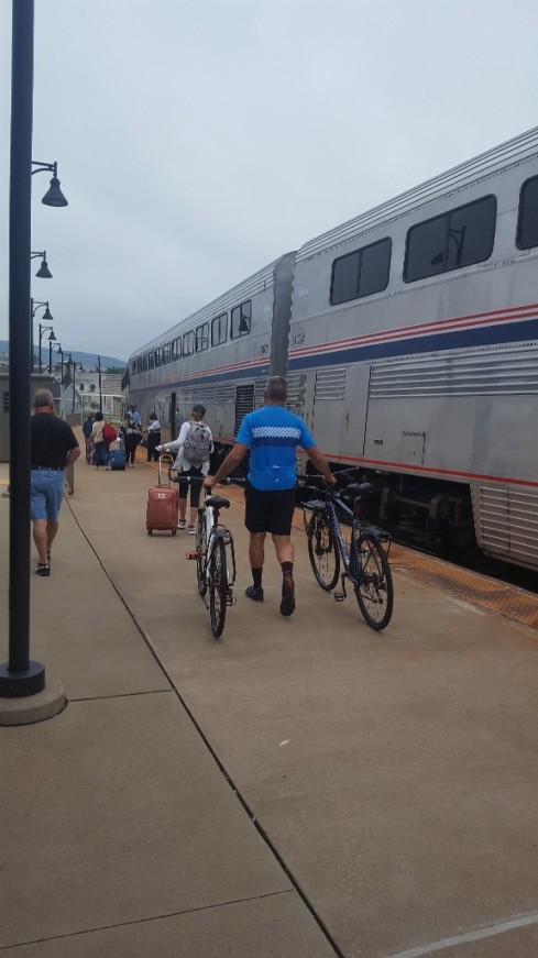
For dinner, we walked up the street to a restaurant called the Rabbit Hole and sat on the deck outside overlooking the Amtrak station. The food was delicious and we enjoyed it thoroughly. Dessert was apricot sorbet topped with crumbled sugared bacon (Oh my goodness it was delicious) for me, and chocolate torte for Jimmy. Both were exceptional.

Here’s our view of the Amtrak station from the deck of the restaurant.

station

After dinner, we walked back to the B&B and I was researching something about the area and stumbled across an interesting tidbit about the Rabbit Hole restaurant where we’d just eaten dinner. It was so interesting that I had to walk back to the restaurant and see if for myself. (My kids would be so embarrassed!) The old building that houses the restaurant (all the buildings here are old) has a spring-fed creek running through it. How did I miss that?!? So I walked back in, asked the young lady at the hostess counter if there was really a creek in the building. She said yes, there is and pointed to what I thought was a fireplace when I walked to the restroom earlier. Built into the exterior wall of the building, was a stone lined opening, with water that flowed from deep within the steep hillside across the street, under the street to the restaurant. It looked like a small cave with water flowing through it. It flowed underground until it reached the wall of the building, pooled in the stone lined basin, and drained through some pipes under the floor and outside to the other side of the building. It was worth the trip back to the restaurant to see this site, though I’m sure my kids are glad they weren’t with me.