Tag Archives: bike overnight trips

Wabash Trace Nature Trail-Iowa

1 Jul

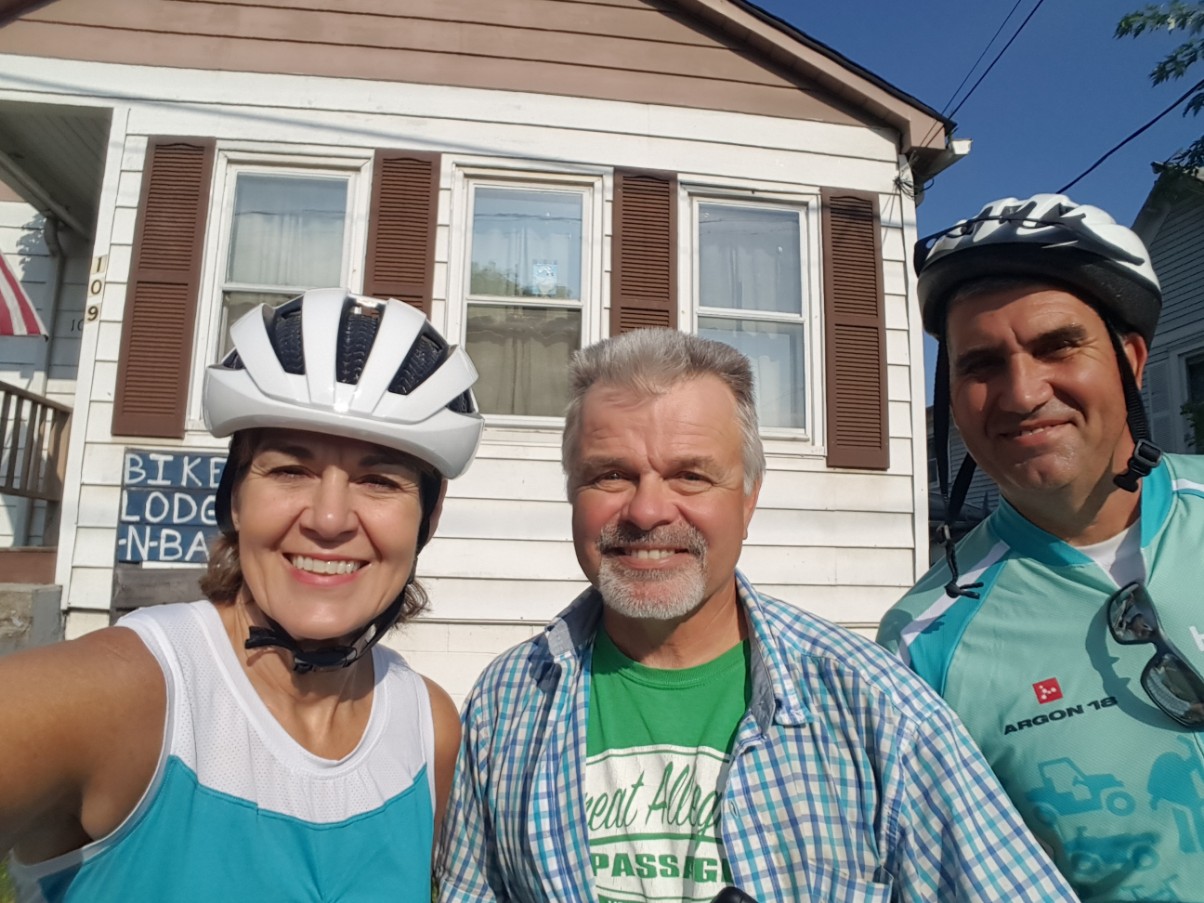
The Wabash Trace spans 63 miles in Iowa from Council Bluffs to Blanchard. It’s a beautiful trail with lots of shade cover, travelling through rural farmland and little towns the railroad left behind. We decided to tackle this one by staying in towns that would give us the opportunity to ride out and back in one direction the first day, then out and back in the opposite direction the next day, giving us two nights at each location. For the first leg of the trip, we chose to stay in Malvern, Iowa and rode from Malvern to Council Bluffs and back the first day, for about 43 miles in distance.

Our accommodations were in an old church! This was one of the few places in town to stay. It’s owned by Zack, who moved back to his hometown after living in Colorado for several years. He was looking for space for his art studio and wanted to save a historic building. The church is approximately 150 years old and was last used for worship in 1969 by the Presbyterian congregation.

The lower floor is the Airbnb space and the upper floor is the art studio. He invites guests to take a look upstairs, and of course I couldn’t resist! I’m glad the beautiful building was saved and repurposed. It’s a treasure in this little town.

Malvern is a cute little town too, with friendly people. We ate dinner at the Classic Cafe and walked around to snap a few pictures.

We woke up to dark skies and a heavy downpour, which delayed us just a bit. We ate at C&M’s Cafe one of two restaurants in town, both mom and pop places, and had a hearty breakfast. The rain finally quit and we were soon able to get on the trail.

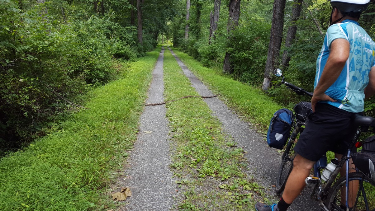
The Wabash Trace follows the old Council Bluffs and St. Louis Railway and first started in 1878. It traverses a route through rural country and connects a handful of little towns. One interesting characteristic of the land here, is that the Wabash Trace travels through the Loess hills area.This is the only place in the United States where this particular soil formation is found at such depth. In fact the only other place in the world similar, is in northern China. Loess hills (pronounced luss) were formed as glaciers retreated and consist of fine particles of wind-blown silt that form gently rolling hills. The unusual depth of the loess in this region is the unique thing about these hills, and the thing that makes them rare. It makes very fertile farm land, but is highly erosive, so farmers have had to take extra measures to keep the land in place. The beautiful farm fields are very healthy looking and most of them are terraced and have a series of earthen berms to keep the rich soil in place.

farm field showing earthen berms
Farm field showing earthen berms along the hillside

The skies soon cleared and we enjoyed the peaceful ride through beautiful farmland and tall grass prairie. There were a couple of people picking berries along the trail and I stopped to ask the first one I saw what he was picking. It was black raspberries, which grow wild all along the trail. He pointed the bushes out to me and I spotted them along the way as I rode, stopping to pick a few for a snack.

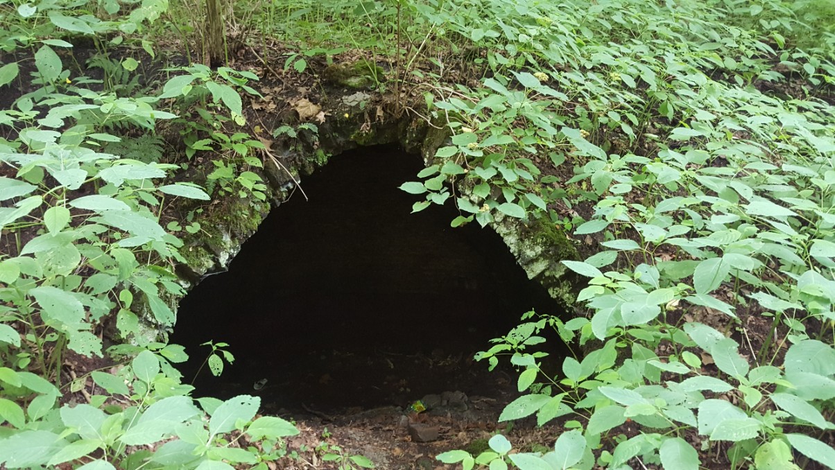
One thing we noticed as we rode, was what appeared to be remnants of train wrecks along the old rail line. I was beginning to wonder how dangerous rail travel must have been back in the day, there were so many wrecked rail cars! So I Googled it. In the 1940’s the railroad placed old rail cars along the banks of creeks to deter further soil erosion (another safeguard for the highly erosive loess soil!) Once I read that, I realized that all the “wrecked” rail cars I’d spotted, were on the banks of creeks. I guess the railroad was ahead of its time in 1940 to reuse, repurpose, and recycle.

One spot along the trail near Mineola though, actually did contain the remnants of a train derailment from 1928, one of the worse disasters on the line. It happened when a wooden trestle over a creek collapsed after a night of heavy rain. Driftwood had apparently collected around the trestle pilings and the pilings could not stand up to the force of water from the storm. Four people were killed in that wreck, when the trestle gave way and plunged the two engine cars and the 6 refrigerated meat cars into the 40 foot ravine. All four of the crewmen who died were from the same town in Missouri.

I took several photos in the little towns and along the trail. It turned into a gorgeous day once the rain had moved out.

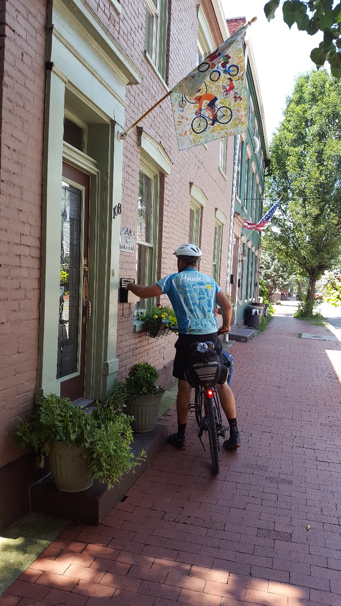
On Thursdays, a local restaurant on the trail sponsors a Taco Ride. We just happened to be riding on a Thursday and stopped at Tobey Jack’s in Mineola to eat our tacos for lunch. I believe the dinner crowd for the taco ride in the evenings is much larger and likely much rowdier, but at lunch, we had the place to ourselves and enjoyed the delicious tacos! There’s also a cute old hotel right across the street, but thankfully we already had accommodations elsewhere!

We woke up the next morning to the sounds of a torrential downpour and to the sounds of things hitting the windows and door of the Airbnb as the wind blew. In fact, when we turned on the news, we saw that the straight-line winds had reached 100-120 mph as the storm (a derecho) had passed through.

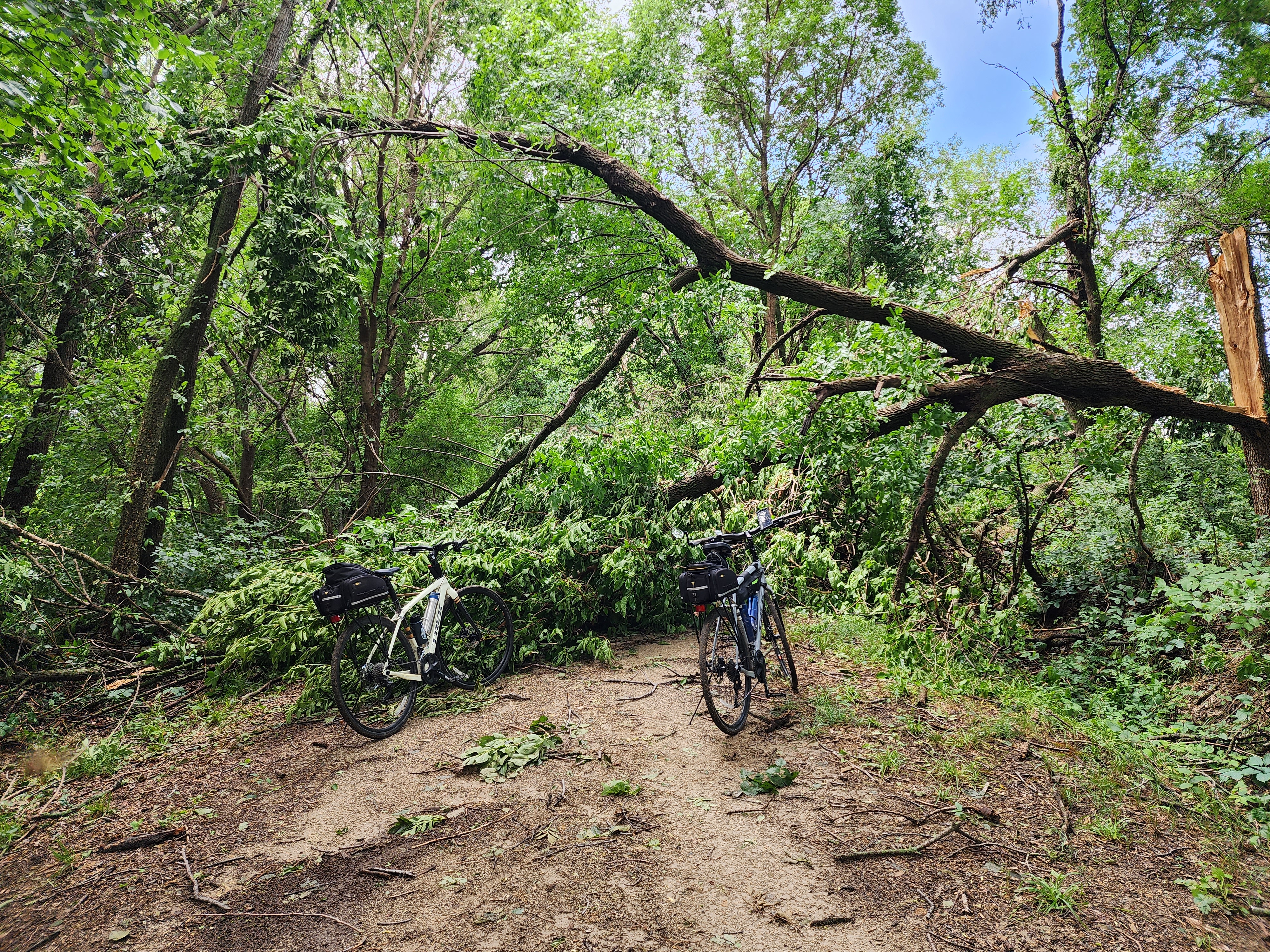
We knew the trail would be even softer today after this second round of heavy rain. On yesterday’s ride we encountered several limbs across the trail from the storms the previous night. On today’s ride, after the storm that barrelled through last night, there were numerous limbs and trees across the trail. We cleared all we could, walked or lifted our bikes over or around others, until we got to a tree that was too big to move and too massive to walk around.

The ride was grueling in the soft, rain-soaked surface that grabbed our tires. It was difficult to get any momentum going because just as we’d pick up a little speed, we’d have to dismount for another fallen tree. When we were finally stopped in our tracks by the last tree, we’d traveled 16 very tough miles, and I was not disappointed to have to turn around at that point!

The tree that ended our ride!

The only disappointment was that the spot where we’d planned to eat lunch was 6 miles past the fallen tree. We made it back to Malvern for a late lunch of cheeseburgers and fries at C&M’s Cafe. Though the ride on the soft surface was very tough, we still enjoyed the beautiful scenery. The trail surface is in great shape with no roots or potholes, but it is definitely a harder ride after 2 nights of heavy rain!

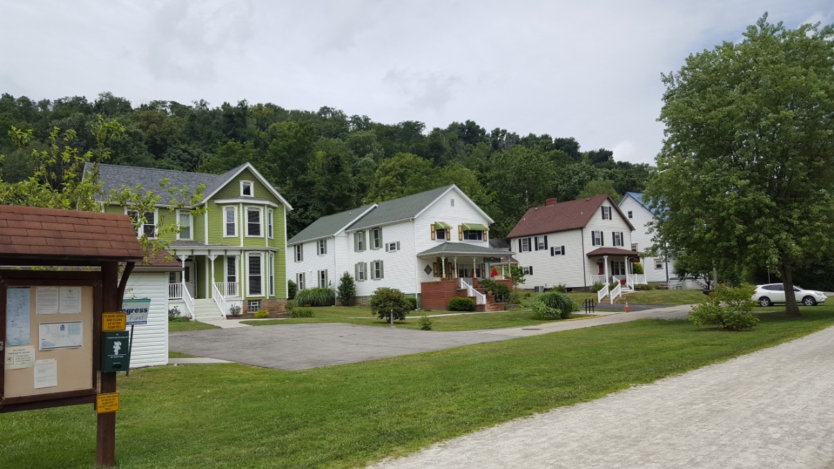
We left Malvern after our two day stay and relocated to Red Oak, Iowa, where we stayed at the Riverbend Heritage Lodge. We checked in, unloaded our things and went to find dinner in town. Red Oak is a bit larger than Malvern, so there were more options. The little town of Red Oak is beautiful, and I took several photos of the old courthouse built in 1890 of red limestone.

Red Oak is not on the bike trail, but it was an easy drive to access the trail. However, another rain set in, this one lasting all day, and we were not able to ride on our third day to conclude this trail. Instead, we used the rest day before heading to Minnesota tomorrow, and are thankful we’re in such a pretty spot to rest!

Riverbend Heritage Lodge

GAP/C&O-Day 10 & 11

17 Jul

smithhousebrkfst

We came down to a beautifully set breakfast table at the Smith House Inn. The big porch doors and windows were open, allowing the fresh, cool morning air into the house through the screens. We enjoyed every bite as we visited with the other guests from Austin, TX. Our ride today takes us from Confluence to Connellsville, where we left our truck 9 days ago.

We finished our breakfast, hopped on the bikes and were off on a cool foggy morning. We crossed 2 bridges as we left Confluence and were once again enjoying the beauty of the trail.

It was a short ride to Ohiopyle, and we had time to walk around, checking out the little shops and the old church.


We grabbed an early lunch at a farm to table restaurant called the Ohiopyle House Cafe.

Ohiopyle State Park is situated right in the center of the beautiful Laurel Highlands, a mountainous region encompassing 3000 square miles in southwest Pennsylvania. I imagine it is extremely busy on the weekends with the hiking trails, bike path, whitewater rafting and waterfall tours. We were glad we caught it on a Monday.

Once we finished lunch, we biked over to Wilderness Voyageurs. They run an outfitters store and offer a number of guided trips and services including a shuttle service. We’d arranged for them to shuttle us the 3 miles over to Fallingwater to take a tour of the famous house designed by Frank Lloyd Wright. Once we saw the very hilly road with no shoulder for biking, we knew we’d made a wise decision. I would not recommend riding it by bike. It was only 3 miles, but it would have been a very difficult and dangerous ride by bike.

We had purchased our tickets for the home tour online a couple of days ago, when we saw that we would be able to make the timing work. Reservations are recommended because the house is a very popular attraction, and tickets typically sell out. Only last week the home was declared a UNESCO World Heritage Site, so I was delighted we were able to work it in to our schedule.

The folks at Wilderness Voyaguers transported us to Fallingwater with plenty of time to spare, and told us to call them when we wanted to be picked up. They dropped us right at the front of the visitor center.

When we checked in for the tour, we were offered an earlier tour, probably due to a cancellation, and we gladly accepted it.  The tour was very interesting and included every room in the house as well as the guest house and carport. No pictures were allowed in the home, but we were allowed to take photos outside of the home after the tour.

We finished the tour, stopped by the cafe in the visitor center to get a cold soda to drink as we waited for our shuttle and even got a free cookie provided in celebration of becoming a UNESCO World Heritage site.

Fallingwater visitor cntr

The shuttle picked us up within a few short minutes of placing the call. We got back on our bikes, which we’d left at Wilderness Voyageurs while we were on the tour. We continued on with our exploration of the Great Allegheny Passage.

We had 17 more miles to cover before we arrived back at our truck, parked at the Connellsville B&B. We’d been away from the truck for 9 days, the longest time we’ve been on a bike trail self-supported. We were able to take everything we needed on our bikes, and there were a few items I took that I didn’t use at all, so next time, I may be able to pack even lighter.

We arrived back at the Connellsville B&B and saw our truck was safe and sound right where we’d left it. The owner greeted us, asked us about our week and took us up to our room. We were in a different room this time and it had beautiful views of the little main street through town.

We got cleaned up and walked down to a family owned Italian restaurant just a couple of blocks from the B&B. Reservations are recommended at Ruvo’s, because it is a very small place, though they did have outdoor seating. Food is served family style, and includes salad and bread. We both ordered one of the specials. One was sausage tortellini and one was gnocchi. The special of the night is a one-serving dish, though it was more than I could eat!

Day 11 was our day to explore more of the trail toward Pittsburgh. We hadn’t started the combined C&O/GAP trail all the way in DC, and we didn’t plan to go all the way to Pittsburgh, but we wanted to see more of the trail in that direction. So after a good breakfast at the Connellsville B&B, we started out toward Pittsburgh.

The trail continues to be in excellent condition and the scenery beautiful. We rode all the way to West Newton (where our B&B is for the night) and stopped and ate lunch at Trailside Cafe. We sat on the deck overlooking the bike trail. I had a delicious salad and Jimmy had a club sandwich. Delicious!

After lunch, we continued on toward Pittsburgh to explore more of the trail in that direction. We passed our B&B as we pedaled through town on the trail. It is directly across from the old train depot, repurposed as a trail visitor center with clean restrooms, water, maps, t-shirts and a friendly staff. We stopped and looked around a bit, and bought t-shirts. We were asked to sign the guest register, as we’ve been asked at every similar stop. These little visitor centers depend on people signing their guest books because it helps them with their funding. So SIGN the guest books when you stop. It helps insure that little places like this will still remain open.

This area had a number of coal mines, all gone now. As we followed the trail along the bank of the Youghiogheny River, or the Yough (prononced Yock -rhymes with sock) as the locals call it, we spotted several relics left from the coal mine era. There were also a good number of signs explaining the relics and giving a history of the area. Also this chunk of coal placed on a sign placard.

coal

The town of Connellsville was at the center of the “Coke Region”. Until the end of World War I, the area around the town was unrivaled in the production of coke, and was known as the coke capitol of the world.

Coke is a hard porous coal residue with a high heating value. It is made by “cooking” coal in sealed ovens. The ovens are beehive shaped and line the banks along both sides of the river. Back in the “coke” heydey, the fires from 35,000 ovens lit up the night sky surrounding Connellsville. I’m sure that was a site to see back in the day.

When the coke was ready, it was loaded onto railcars bound for Pittsburgh and used in the making of steel.

In one particular section of trail, I was able to spot the beehive ovens every few feet lining on old road or railroad on a hillside along the trail. It was hard to get a photo because of the foliage. The ovens would probably be much easier to spot in the winter, but I did take a short little hike off the trail to get a picture of one.

beehive oven

I read all the historical markers about the coal mines along the trail.  We passed through 3 or 4 “patch towns”. Patch towns were small villages consisting of “company houses”. The Pittsburgh Coal Company provided housing for their employees working in the mines and at the coke ovens. Most were built between 1900-1920. There were only a few floorplans. They consisted of duplexes, larger homes for managers, and bunk houses for employees with no family. Though most have been updated to some degree, the lay-out of the company town is still the same, and though many of them are single family homes now, you can still see the footprint of the duplex with 2 front doors, etc. All of the homes in these little patch towns have the same footprint and it is interesting to see how homeowners have modified them to make them uniquely theirs.

There was a terrible mining accident in this region in 1907. A gas and coal dust explosion killed 239 miners at Darr Mine, and was one of the worst coal mine tragedies in the US. A historical marker is placed near the trail telling the story of the Darr mine disaster.

One other remnant of the coal mining era can be seen along the trail, Red Waterfall. Red Waterfall flows from water that comes from far underground. The unusual thing about the waterfall though is its color. A rock seal that formed over the massive Pittsburgh coal seam thousands of years ago contained “pyrite”, made of iron and sulfur. Coal mining exposed pyrite to oxygen and ground water. This in turn produced sulfuric acid and a number of red, yellow, and orange compounds. The rich orange/red color came from iron, and is known as Acid Mine Drainage. This was the largest orange/red water we saw, but noticed it in a smaller waterfall and in a creek that runs along the trail. All were remnants of the coal mining that occurred here over 100 years ago.

Red Falls

We traveled on and stopped for an ice cream cone at Yough Twister. We got a blackberry vanilla yogurt swirl. It was a cute tiny place with a huge menu. I was sorry we weren’t there at meal time!

There are several spots along the trail where homeowners that border the trail have added extra touches to make trail users feel welcome. We saw a number of shady benches with flowers tended in pots, an inviting bench under an old shady apple tree, and a cooler of bottled water for any thirsty traveler. These little places always make me smile!

Shortly after passing Buena Vista, we turned around and headed back toward our B&B, having ridden to  within 27 miles  of Pittsburgh. We passed many more beautiful sites, and I took a few more pictures even though we had doubled back. I couldn’t resist!

We are staying in West Newton at Bright Morning Bed & Breakfast. We’d passed it earlier in the day on our way out to see more of the trail, and were ready to get back to it and check in.

Bright Morning B&B2

The B&B is made up of 4 homes bought over a period of years by the owner. The first house she bought was one that an elderly lady had left to the local Methodist Church. The church sold it and she bought it. She started out with one guest room and the demand was so high, she added other homes to her collection. All of the homes have been lovingly restored. Breakfast would be serve in another of the homes 2 doors down from the one we were in. Our room was on the top floor of the green house with a beautiful view of the bike trail and the old train depot.

We returned to the Trailside Cafe for dinner, and once again sat on the deck overlooking the bike trail. It was a beautiful ending to the day. We are both sad to see this trip end. But have already begun dreaming about our next bike trip! Tomorrow, we pedal back to our truck in Connellsville, spend one last night, and head home.


GAP/C&O-Day 7-Leaving the Nicest Guy You’d Ever Want to Meet

14 Jul

Bikepath

We slept well in the cozy little Bikepath Bed & Bath and were looking forward to breakfast. Dan had asked us what our preferred time would be to eat, and we chose 7:30 am. He said that seemed to be the preferred time for most bikers, because when asked, that’s the time they usually chose. He didn’t have any other guests last night, but it’s been a busy season for him so far. He has been full every night for some time, and is expecting 2 young ladies later in the day.

brkfst

He had 2 places set at the table, and soon called us for breakfast and asked us to sit down. First he brought in a skillet of scrambled eggs and divided them between our two plates. I kid you not, we each had at least 5 eggs, maybe 6. He may have scrambled a whole dozen for just the 2 of us. Next came the fried potatoes then a big piece of ham. He had made homemade bread the day before and he cut two big, thick slices of bread and toasted them. Each slice would have consisted of at least 4 regular slices of bread.  It was all good, but would take quite a few miles to burn those calories.

brkfst2

As we sat eating, he sat down at the head of the little kitchen table across from Jimmy and picked up a book he had lying there with some other items on the table. He said he always liked to read an essay out of a book written by Albert Einstein, because Einstein was such a smart fellow. I don’t know if he read the same essay to each group that stayed, or if he read a different one each day. The essay he read to us was entitled “The World as I See It”. I took a picture of that page in his book, and below is a portion of what he read to us;

essay

How strange is the lot of us mortals! Each of us is here for a brief sojourn; for what purpose he knows not, though he sometimes thinks he senses it. But without deeper reflection one knows from daily life that one exists for other people—first of all for those upon whose smiles and well-being our own happiness is wholly dependent, and then for the many, unknown to us, to whose destinies we are bound by the ties of sympathy. A hundred times every day I remind myself that my inner and outer life are based on the labors of other men, living and dead, and that I must exert myself in order to give in the same measure as I have received and am still receiving. I am strongly drawn to a frugal life and am often oppressively aware that I am engrossing an undue amount of the labor of my fellow-men. I regard class distinctions as unjustified and, in the last resort, based on force. I also believe that a simple and unassuming life is good for everybody, physically and mentally.”

It was clear that he’d spent a great deal of time pondering those words. He was embracing the simple life, embracing the thought that one exists for other people, drawn to a frugal life and the belief that plain living was good for everybody, physically and mentally. There’s a lot of wisdom there.

We were sad to leave our new friend, but we had more trail to cover. We packed up our stuff, took a photo out in front of his home, and headed on our way, having been blessed once again by our interactions with such a nice man.

see you soon I hope

What a gorgeous day! The rain and clouds from yesterday afternoon were gone and what was left were brilliant blue skies. We were riding the last portion of the C&O Canal Towpath today, with our destination at the end of the trail to be Cumberland, MD. We hopped on our bikes, took the quick connector trail out of Paw Paw, WV and back into Maryland as we crossed the river.

We saw quite a few fishermen today, as there’s a big portion of the canal that has been dammed up and apparently makes a great little fishing spot. Each fisherman we passed waved or called out a greeting. 

The rain left more puddles behind, so we had to navigate through them carefully so as not to wipe out with our heavy loads. A piece of good advice we picked up from bikers accustomed to these trail conditions is to not dodge the puddles. It is so easy to lose control of a bike that’s fully loaded with gear. The best thing to do is to lift yourself off the seat just a bit and roll right through the water puddles. Initially, I tried to weave my way around the puddles, and it was hard to maintain balance at times. After I received that advice, I just rolled right through and it was much easier. Though my legs were much muddier…

Now that my worries about the potential bad weather from yesterday were behind me, I had a little more time to recall a warning I received on the first day. I’d put it out of my head until now. (There’s only so much room in my head). But since I knew we would be continuing our ride through the most remote region, those warnings resurfaced.

We had just gotten off the train in Harper’s Ferry and were rolling our bikes off the station platform when an elderly couple motioned us over. They were sitting in their car, parked in the space right beside the train station. They asked where we were from, what we were doing, the usual stuff. The man told us he was 85 and the woman may have been a little bit younger because she was driving. But in the course of the conversation, the lady started going over a safety checklist with us now that she’d found out we were riding the C&O.

Her: “Did you bring pepper spray?”

Me: “I have no idea, did we?, turning to look at Jimmy

Jimmy: “I have a little”

Her: “Well you’re gonna need it”

Me: “Really?  Why?”

Her: “You’ll need it for two-legged and four-legged critters” 

Me: “Oh goodness! What kind of 4-legged critters are we talking about?”

Her: “mostly bobcats and cougars”

Her: “Did you bring any snacks?”

Me: “ well, yes I brought some snacks to eat along the trail in case we get hungry”

Her: “You better be careful. Those wild cats can smell a snack from miles away”

Me: “ok, I’ll be careful”

Her: “If those wild cats get hungry, they will eat whatever they can find, even you”

Her: “and if they smell your snacks, they’ll come running from miles around. If you stop to eat a snack, you better eat it fast.”

Me: “I’ll certainly keep that in mind!”

I was beginning to wonder if this was all a bad idea. We hadn’t even made it out of the parking lot, and I was already worried I’d starve to death on the trail. Or worse!

So as I’m riding along today, I was thinking about these wild animals. I already feel it’s my duty to be the official snake spotter on every bike trip. I saw 3 yesterday and already 1 today. Jimmy just doesn’t give that job the vigilance I think it deserves. He just rolls along, taking in the view, enjoying the sites with hardly a glance at the trail surface. I on the other hand examine every stick, every shadow, every unusual shape for any threat, real or perceived. It’s amazing how a brown curled up dead fern leaf looks just like a poisonous snake from a distance. Now I found I was on the lookout for wildcats, cougars, bobcats, whatever. And let’s not forget bears. I know they’re out there. Here’s a scene that stopped me in my tracks (allowing Jimmy to practice stopping on a dime with no warning as he followed behind). That looked exactly like a huge snake! It was just a vine.

stick

It’s impossible to ride along and not eat a snack for energy because of the calorie burn. But I tried to do it as quickly and efficiently as I possibly could. I keep snacks in my jersey pockets for easy access while riding. I figured if I could get the whole snack in my mouth at once, the bobcats wouldn’t smell it as much. I nearly choked to death on a whole granola bar trying to keep my mouth shut around it, praying to God that Jimmy knew the Heimlich maneuver and could recognize the universal distress signal if I had to use it. Did he? I’ve never actually asked him that! I’ll have to find out before I stuff another granola bar down my throat.

I got that chewed up and swallowed (barely!) and realized my fingers were sticky. Darn it! I must have gotten some honey granola on my fingers trying to shove the whole thing in my mouth!  I could just imagine the smell of honey, oats, and almonds wafting behind me as I rode. I’d have every predatory cat in the county after me if I weren’t more careful.

The ride continued to be through beautiful country. I took several more pictures today.

Thankfully, we continued on without being attacked and were soon at Spring Gap trailhead. Dan had advised us that we could avoid the last 8 miles of the roughest section of trail by taking highway 51 into Cumberland. We typically avoid travelling on roads with cars, but will do it if we have to. The last stretch of the canal to be built was the section that arrived in Cumberland. By the time they made it there, the canal project was out of money, and the railroad had beat them to Cumberland by 8 years! Instead of spending money they didn’t have to build the last 8 miles of towpath, they decided to let the mules make their own towpath alongside the canal. The last 8 miles are dirt, and after yesterday’s rains, would be a slippery, muddy, pothole mess. That last 8 miles would take a long time with our heavily loaded bikes that would likely have to be pushed over trail hazards. No thank you. So to the road we went. It wasn’t a bad ride. We had a wide shoulder to use most of the way and there was one pretty good size hill as we climbed out of the canal elevation, but after that, we basically coasted all the way into Cumberland.


As soon as we made it into town, we stopped and had lunch at a DQ while we checked Google maps to find the best route to the B&B.

DQ

We got back on the road and made our way downtown, passing many historic buildings and homes as we went. We got a nice little tour of downtown Cumberland by bike.

We arrived at The Inn on Decatur and were  told to check the mailbox for the key. It wasn’t in there, we were earlier than expected, but the owner was home and welcomed us in.

Decatur Inn

She showed us where to lock our bikes overnight and provided a hose for us to clean up the bikes after the muddy ride. We loved our room and had the whole top floor to ourselves since we are the only guests for the night. We also had a kitchen with a basket of “Health food”, as she described it. (There may or may not be a Reese’s missing…) We have use of a washer and dryer once again, and were glad to use it on our muddy clothes.

At the owner’s recommendation, we walked to the old downtown area, where they have a very cool pedestrian mall, called Canal Place. The area of old downtown buildings has been restored and repurposed into shops, restaurants and outdoor dining.

We ate at Ristorante Ottaviani. We definitely carb loaded. The food was delicious.

Today we say goodbye to the C&O Canal Towpath, which makes us sad, but tomorrow, we say hello to the Great Allegheny Passage!